Alabama County Map
Alabama has 67 counties. Jefferson County is the most populous, with 674,721 residents in 2020, and Baldwin County is the largest by land area, at 1,589.8 sq mi. The capital, Montgomery, is the county seat of Montgomery County.
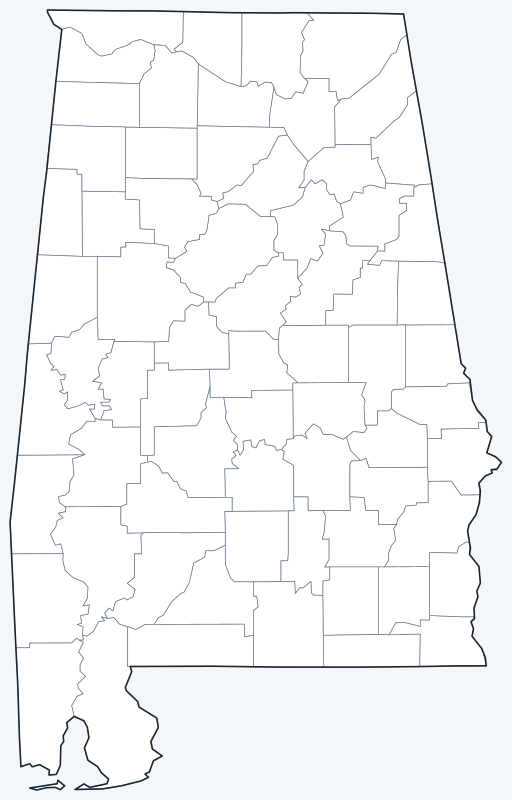
Counties are switched on when the map loads; hover a county for its name, or untick Show counties to hide them.
List of Alabama counties
All 67 counties in alphabetical order. Click a column heading to sort.
| County | County seat | Population (2020) | Land area (sq mi) |
|---|---|---|---|
| Autauga County | Prattville | 58,805 | 594.5 |
| Baldwin County | Bay Minette | 231,767 | 1,589.8 |
| Barbour County | Clayton | 25,223 | 885.0 |
| Bibb County | Centreville | 22,293 | 622.5 |
| Blount County | Oneonta | 59,134 | 644.9 |
| Bullock County | Union Springs | 10,357 | 622.8 |
| Butler County | Greenville | 19,051 | 776.8 |
| Calhoun County | Anniston | 116,441 | 605.9 |
| Chambers County | LaFayette | 34,772 | 596.6 |
| Cherokee County | Centre | 24,971 | 553.5 |
| Chilton County | Clanton | 45,014 | 692.8 |
| Choctaw County | Butler | 12,665 | 913.5 |
| Clarke County | Grove Hill | 23,087 | 1,238.4 |
| Clay County | Ashland | 14,236 | 604.0 |
| Cleburne County | Heflin | 15,056 | 560.1 |
| Coffee County | Elba and Enterprise | 53,465 | 679.0 |
| Colbert County | Tuscumbia | 57,227 | 593.0 |
| Conecuh County | Evergreen | 11,597 | 850.3 |
| Coosa County | Rockford | 10,387 | 650.9 |
| Covington County | Andalusia | 37,570 | 1,030.6 |
| Crenshaw County | Luverne | 13,194 | 608.9 |
| Cullman County | Cullman | 87,866 | 734.7 |
| Dale County | Ozark | 49,326 | 561.1 |
| Dallas County | Selma | 38,462 | 978.7 |
| DeKalb County | Fort Payne | 71,608 | 777.1 |
| Elmore County | Wetumpka | 87,977 | 618.5 |
| Escambia County | Brewton | 36,757 | 945.4 |
| Etowah County | Gadsden | 103,436 | 535.1 |
| Fayette County | Fayette | 16,321 | 627.7 |
| Franklin County | Russellville | 32,113 | 633.9 |
| Geneva County | Geneva | 26,659 | 574.5 |
| Greene County | Eutaw | 7,730 | 647.0 |
| Hale County | Greensboro | 14,785 | 644.0 |
| Henry County | Abbeville | 17,146 | 561.8 |
| Houston County | Dothan | 107,202 | 579.8 |
| Jackson County | Scottsboro | 52,579 | 1,078.0 |
| Jefferson County | Birmingham | 674,721 | 1,111.5 |
| Lamar County | Vernon | 13,972 | 604.8 |
| Lauderdale County | Florence | 93,564 | 668.0 |
| Lawrence County | Moulton | 33,073 | 690.7 |
| Lee County | Opelika | 174,241 | 607.5 |
| Limestone County | Athens | 103,570 | 560.0 |
| Lowndes County | Hayneville | 10,311 | 716.1 |
| Macon County | Tuskegee | 19,532 | 608.7 |
| Madison County | Huntsville | 388,153 | 801.6 |
| Marengo County | Linden | 19,323 | 976.9 |
| Marion County | Hamilton | 29,341 | 742.3 |
| Marshall County | Guntersville | 97,612 | 565.8 |
| Mobile County | Mobile | 414,809 | 1,229.4 |
| Monroe County | Monroeville | 19,772 | 1,025.7 |
| Montgomery County | Montgomery | 228,954 | 785.3 |
| Morgan County | Decatur | 123,421 | 579.7 |
| Perry County | Marion | 8,511 | 719.7 |
| Pickens County | Carrollton | 19,123 | 881.4 |
| Pike County | Troy | 33,009 | 672.1 |
| Randolph County | Wedowee | 21,967 | 580.6 |
| Russell County | Phenix City | 59,183 | 641.2 |
| Shelby County | Columbiana | 223,024 | 785.4 |
| St. Clair County | Ashville and Pell City | 91,103 | 631.6 |
| Sumter County | Livingston | 12,345 | 903.8 |
| Talladega County | Talladega | 82,149 | 736.8 |
| Tallapoosa County | Dadeville | 41,311 | 716.5 |
| Tuscaloosa County | Tuscaloosa | 227,036 | 1,320.8 |
| Walker County | Jasper | 65,342 | 791.0 |
| Washington County | Chatom | 15,388 | 1,080.2 |
| Wilcox County | Camden | 10,600 | 887.9 |
| Winston County | Double Springs | 23,540 | 613.0 |
Most populous counties
Alabama had 5,024,279 residents in the 2020 Census. The five most populous counties:
- Jefferson County: 674,721 (13.4% of the state)
- Mobile County: 414,809 (8.3% of the state)
- Madison County: 388,153 (7.7% of the state)
- Baldwin County: 231,767 (4.6% of the state)
- Montgomery County: 228,954 (4.6% of the state)
Together these five hold 38.6% of the state’s population. The least populous is Greene County, with 7,730 residents.
Largest and smallest counties
By land area, the largest are Baldwin County (1,589.8 sq mi), Tuscaloosa County (1,320.8 sq mi) and Clarke County (1,238.4 sq mi). The smallest is Etowah County, with 535.1 sq mi of land, followed by Cherokee County (553.5 sq mi). The average county covers 755.9 sq mi of land.
Baldwin County has 1,589.8 sq mi of land but 2,027.3 sq mi in total; the difference is water.
How Alabama counties work
Each of Alabama’s 67 counties is governed by an elected county commission. Most counties have one county seat, but two have two: Coffee County (Elba and Enterprise) and St. Clair County (Ashville and Pell City).
Birmingham is the seat of Jefferson County, the most populous county. Huntsville, the largest city, is the seat of Madison County; parts of the city extend into Limestone and Morgan counties.
Printable Alabama county maps
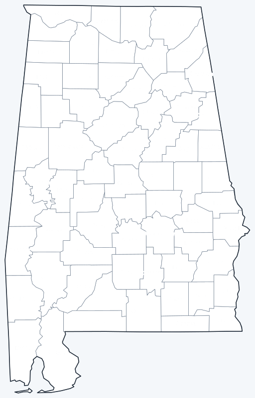
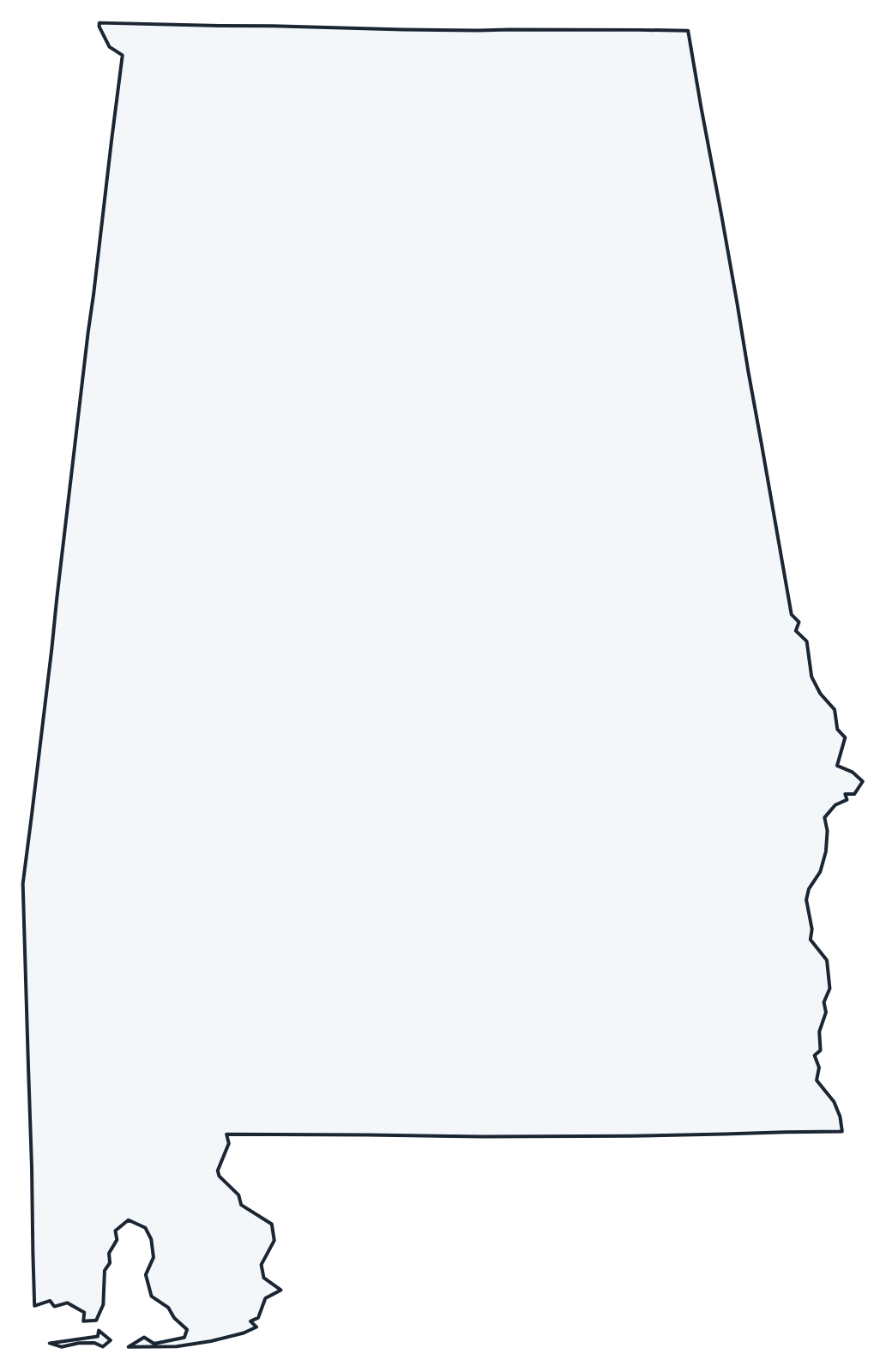
Free to print for personal and classroom use: a labeled map with every county name, and a blank version for quizzes and coloring.
Frequently asked questions
How many counties are in Alabama?
Alabama has 67 counties.
What is the largest county in Alabama?
Baldwin County, with 1,589.8 sq mi of land.
What is the most populous county in Alabama?
Jefferson County, with 674,721 residents in 2020, 13.4% of the state.
What county is Huntsville in?
Huntsville, the largest city, is the seat of Madison County. Parts of the city extend into Limestone and Morgan counties.
What county is Montgomery in?
Montgomery, the state capital, is the seat of Montgomery County.
More county maps
Back to the Alabama state map. County maps of neighboring states: Florida · Georgia · Mississippi · Tennessee.
Browse all 50 state maps.
Sources: U.S. Census Bureau (2020 Census, 2020 Gazetteer, boundaries); county seats: Wikipedia and Wikidata, cross-checked. Last reviewed October 2026.