Delaware State Map
Delaware occupies the northeastern part of the Delmarva Peninsula on the Atlantic coast, bordered by Pennsylvania to the north, Maryland to the west and south, and New Jersey across the Delaware River and Delaware Bay. This Delaware state map shows its cities, beach towns and three counties. The capital is Dover and the largest city is Wilmington.
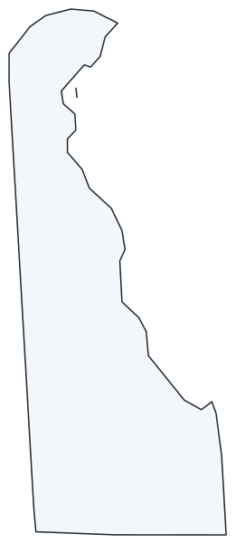
The interactive map shows Delaware’s largest cities (capital in red) on an OpenStreetMap base map. Turn on Show counties to see all county lines and hover for names.
Delaware quick facts
| Capital | Dover |
|---|---|
| Largest city | Wilmington |
| Population (2020) | 989,948 (45th of 50) |
| Total area | 2,489 sq mi (49th of 50) |
| Statehood | December 7, 1787 (1st state) |
| Counties | 3 counties · County map |
| Abbreviation | DE (AP style: Del.) |
| Region | South (South Atlantic division) |
| Time zone | Eastern Time (ET) |
| Highest point | Ebright Azimuth area, about 448 ft |
| Borders | Pennsylvania (north), Maryland (west and south), New Jersey (east, across the Delaware River and Bay), Atlantic Ocean (east) |
Where is Delaware?
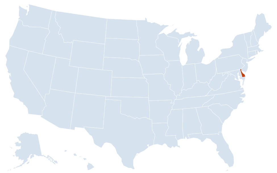
Delaware is in the South region of the United States. Neighboring states: Maryland, New Jersey, Pennsylvania.
Largest cities in Delaware
Delaware’s cities are small; much of the population lives in unincorporated suburbs of New Castle County, such as Bear (23,060 in 2020), which are not included in this table of incorporated cities and towns.
| Rank | City | Population (2020) |
|---|---|---|
| 1 | Wilmington | 70,898 |
| 2 | Dover (capital) | 39,403 |
| 3 | Newark | 30,601 |
| 4 | Middletown | 23,192 |
| 5 | Smyrna | 12,883 |
| 6 | Milford | 11,190 |
Geography of Delaware
Delaware is about 96 miles long and between 9 and 35 miles wide. Almost all of it lies on the flat Atlantic Coastal Plain, and it has the lowest average elevation of any state. Each of its three counties forms a distinct part of the map.
New Castle County (north)
The northern tip, above the fall line at Wilmington, is part of the rolling Piedmont. The Brandywine Valley and the state’s highest ground, near Ebright Road on the Pennsylvania line, are here. Wilmington, Newark and the historic town of New Castle anchor the most populous county, which reaches south past the Chesapeake and Delaware Canal to Middletown.
Kent County (center)
Dover, the capital, sits in the middle of the state amid farmland. Dover Air Force Base lies just southeast of the city, and Bombay Hook National Wildlife Refuge protects tidal marsh along Delaware Bay.
Sussex County (south)
The largest county by area holds the state’s Atlantic beaches: Lewes and Cape Henlopen at the mouth of Delaware Bay, then Rehoboth Beach, Dewey Beach, Bethany Beach and Fenwick Island. Inland are the county seat of Georgetown, Seaford on the Nanticoke River, and farms and poultry operations that stretch to the Maryland line.
Water and the Twelve-Mile Circle
The Delaware River and Delaware Bay form the entire eastern boundary. Delaware’s curved northern border is an arc of a circle centered on the town of New Castle, and within that circle the state owns the river to the low-water mark on the New Jersey shore. The Chesapeake and Delaware Canal cuts across the peninsula, linking Delaware Bay with Chesapeake Bay.
Boundary lines
The southern border with Maryland follows the Transpeninsular Line, surveyed in 1750–1751. The western border is a north–south line completed by Charles Mason and Jeremiah Dixon in the 1760s, as part of the same survey that produced the Mason–Dixon line between Maryland and Pennsylvania. A small sliver where the circle meets the Maryland and Pennsylvania lines, known as the Wedge, was disputed until 1921, when it was confirmed as part of Delaware.
First State National Historical Park preserves colonial sites in New Castle, Dover and the Brandywine Valley.
Major highways
- I-95: from Maryland past Newark (as the Delaware Turnpike) through Wilmington to Pennsylvania, part of the main East Coast corridor.
- I-495: a bypass along the Wilmington waterfront.
- I-295: from I-95 to the Delaware Memorial Bridge and the New Jersey Turnpike.
- DE 1: a toll highway from near Christiana south through Middletown and Dover to the beaches, then along the coast to Fenwick Island.
- US 13: the length of the state from Wilmington through Dover, Seaford and Laurel to Maryland.
- US 113: from Dover south through Milford, Georgetown and Selbyville toward Maryland.
- Cape May–Lewes Ferry: crosses the mouth of Delaware Bay to Cape May, New Jersey.
Printable Delaware maps
A blank outline of Delaware for coloring, labeling or school projects, and a locator map showing the state within the US. Free for personal and classroom use.
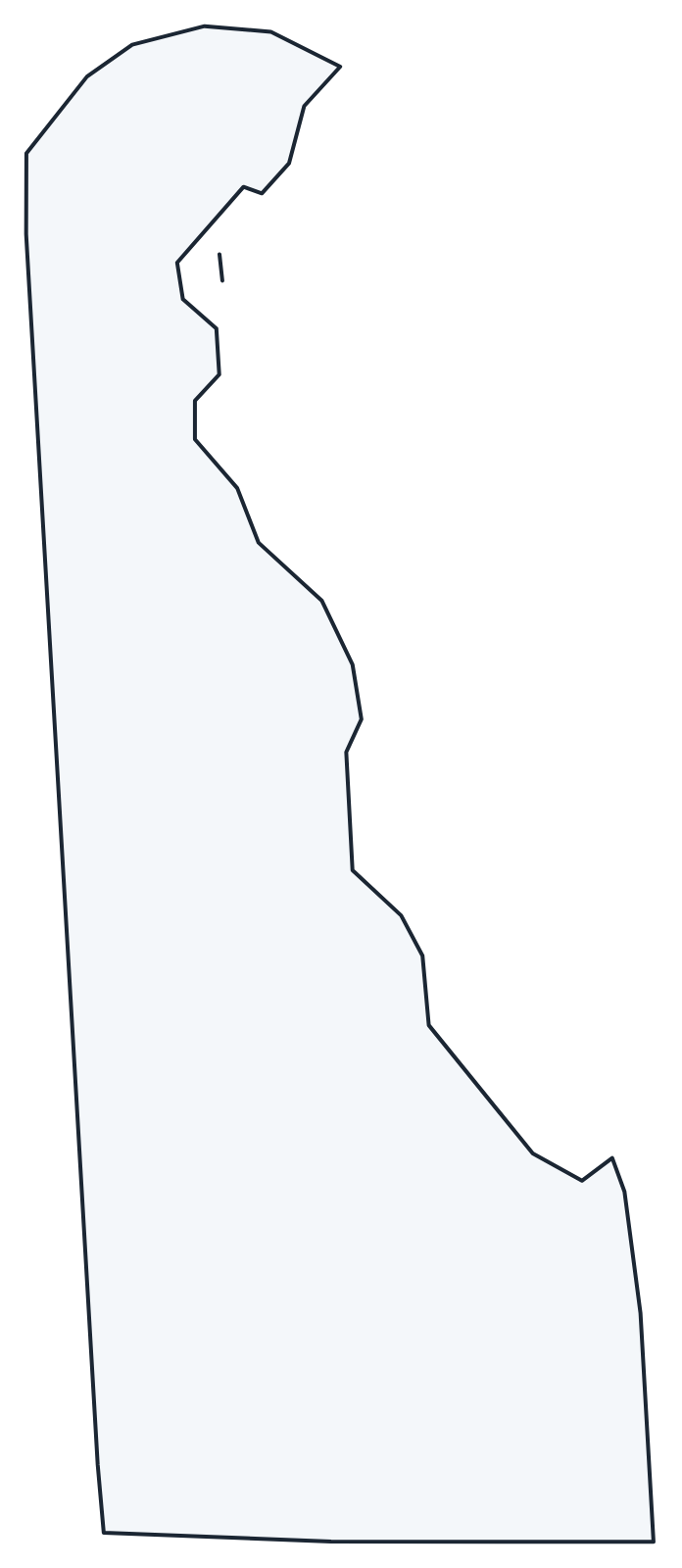
For all 3 counties with county seats and 2020 population, and a printable labeled map, see the Delaware county map.
Frequently asked questions
What is the capital of Delaware?
Dover, in Kent County near the center of the state. The capital moved there from New Castle in 1777. Wilmington is the largest city, but not the capital.
How many counties are in Delaware?
Three: New Castle, Kent and Sussex, the fewest of any state. New Castle County is the most populous (570,719 in 2020), and Sussex County is the largest by area.
What time zone is Delaware in?
The whole state uses Eastern Time and observes daylight saving time.
Why is Delaware called the First State?
On December 7, 1787, Delaware became the first state to ratify the US Constitution.
Neighboring and nearby states
Maryland · New Jersey · Pennsylvania · Also in the South Atlantic division: Florida, Georgia, Maryland, North Carolina, South Carolina, Virginia, West Virginia
Back to the US state map or browse all 50 state maps.
Sources: U.S. Census Bureau (2020 Census, boundaries), USGS. Last reviewed October 2026.