Wyoming State Map
Wyoming is a rectangular state in the Mountain West where the Great Plains meet the Rocky Mountains, bordered by Montana, South Dakota, Nebraska, Colorado, Utah and Idaho. It has the smallest population of the 50 states. Its capital and largest city is Cheyenne, in the southeast corner.
The interactive map shows Wyoming’s largest cities (capital in red) on an OpenStreetMap base map. Turn on Show counties to see all county lines and hover for names.
Wyoming quick facts
| Capital | Cheyenne |
|---|---|
| Largest city | Cheyenne |
| Population (2020) | 576,851 (50th of 50) |
| Total area | 97,813 sq mi (10th of 50) |
| Statehood | July 10, 1890 (44th state) |
| Counties | 23 counties · County map |
| Abbreviation | WY (AP style: Wyo.) |
| Region | West (Mountain division) |
| Time zone | Mountain Time (MT) |
| Highest point | Gannett Peak, about 13,804 ft |
| Borders | Montana (north), South Dakota (northeast), Nebraska (southeast), Colorado (south), Utah (southwest), Idaho (west) |
Largest cities in Wyoming
| Rank | City | Population (2020) |
|---|---|---|
| 1 | Cheyenne (capital) | 65,132 |
| 2 | Casper | 59,038 |
| 3 | Gillette | 33,403 |
| 4 | Laramie | 31,407 |
| 5 | Rock Springs | 23,526 |
| 6 | Sheridan | 18,737 |
| 7 | Green River | 11,825 |
| 8 | Evanston | 11,747 |
| 9 | Jackson (town) | 10,760 |
| 10 | Riverton | 10,682 |
Only Cheyenne and Casper have more than 50,000 people. Laramie County, around Cheyenne, is the most populous county, with 100,512 residents in 2020.
Geography of Wyoming
Wyoming’s borders are straight surveyed lines, so the state is almost a perfect rectangle. Inside it, mountain ranges alternate with wide, dry basins, and the Continental Divide crosses from the northwest corner to the south-central border.
Yellowstone and Grand Teton
The northwest corner holds most of Yellowstone National Park, established in 1872 as the first national park, with its geysers, hot springs and Yellowstone Lake. Just south, Grand Teton National Park rises above the valley of Jackson Hole and the town of Jackson.
Wind River Range
A long granite range in west-central Wyoming with Gannett Peak, the state’s highest point, and many of the largest glaciers in the US Rocky Mountains. Lander and Pinedale lie at its foot, and the Wind River Indian Reservation lies to the east.
Bighorn Mountains and Bighorn Basin
The Bighorn Mountains rise west of Sheridan and Buffalo. Beyond them, the Bighorn Basin holds Cody, Worland and Thermopolis, ringed by the Absaroka and Owl Creek mountains.
Great Divide Basin and the southwest
The high desert between Rawlins and Rock Springs, including the Red Desert, is an enclosed basin: rain that falls there drains to neither ocean. The Green River flows south through the region toward Utah and the Colorado River. Evanston sits in the far southwest corner.
Southeast mountains and plains
The Laramie Mountains and the Snowy Range of the Medicine Bow Mountains rise west of Cheyenne and Laramie. East of them, the High Plains run to Nebraska, with ranches, wheat and the North Platte River valley around Torrington.
Powder River Basin and the northeast
Rolling grassland and the country’s largest coal-mining district around Gillette. In the far northeast corner, Devils Tower became the first national monument in 1906, near the western edge of the Black Hills.
Rivers
Major rivers drain Wyoming in every direction. The Snake River runs from Yellowstone through Jackson Hole into Idaho; the Green River flows south into Utah; the North Platte enters from Colorado, loops north to Casper and turns east into Nebraska; and the Yellowstone, Bighorn and Powder rivers flow north into Montana.
Major highways
- I-80: across southern Wyoming from the Utah line at Evanston through Green River, Rock Springs, Rawlins, Laramie and Cheyenne to Nebraska; high winds and snow can close it in winter.
- I-25: from the Colorado line south of Cheyenne north through Wheatland, Douglas and Casper to Buffalo, where it ends at I-90.
- I-90: from the Montana line north of Sheridan through Buffalo, Gillette and Sundance to South Dakota.
- US 191, US 189 and US 89: the main routes through western Wyoming, linking Rock Springs, Pinedale, Jackson and Yellowstone.
- US 14/16/20: from Cody west to Yellowstone’s East Entrance; US 14 and US 16 also cross the Bighorn Mountains.
- US 20/26 and US 287: US 20/26 links Casper with Shoshoni and Riverton; US 287 links Rawlins with Lander.
Printable Wyoming maps
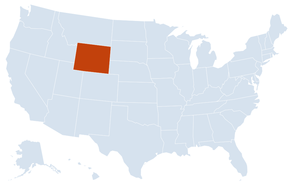
A blank outline of Wyoming for coloring, labeling or school projects, and a locator map showing the state within the US. Free for personal and classroom use.
For all 23 counties with county seats and 2020 population, and a printable labeled map, see the Wyoming county map.
Frequently asked questions
What is the capital of Wyoming?
Cheyenne, which is also the largest city. It lies on I-80 and I-25, about 10 miles north of the Colorado line.
How many counties are in Wyoming?
There are 23 counties. Laramie County (Cheyenne) is the most populous, and Sweetwater County (Green River) is the largest by area.
What time zone is Wyoming in?
The whole state uses Mountain Time and observes daylight saving time.
Is Yellowstone National Park in Wyoming?
Mostly. The park is in the northwest corner of Wyoming, with narrow strips extending into Montana and Idaho. Its North Entrance at Gardiner and West Entrance at West Yellowstone are both in Montana.
Neighboring and nearby states
Montana · South Dakota · Nebraska · Colorado · Utah · Idaho · Also in the Mountain division: Arizona, Colorado, Idaho, Montana, Nevada, New Mexico, Utah
Back to the US state map or browse all 50 state maps.
Sources: U.S. Census Bureau (2020 Census, boundaries), USGS, National Park Service. Last reviewed October 2026.