Mississippi County Map
Mississippi has 82 counties. Hinds County is the most populous with 227,742 residents in 2020, and Yazoo County is the largest by land area at 922.3 sq mi. Jackson, the capital, is one of the two seats of Hinds County.
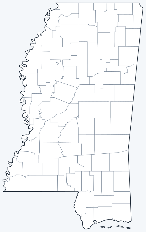
County lines are switched on when the interactive map loads. Hover over a county to see its name, or untick Show counties to hide them.
List of Mississippi counties
| County | County seat | Population (2020) | Land area (sq mi) |
|---|---|---|---|
| Adams County | Natchez | 29,538 | 462.3 |
| Alcorn County | Corinth | 34,740 | 400.0 |
| Amite County | Liberty | 12,720 | 730.1 |
| Attala County | Kosciusko | 17,889 | 735.0 |
| Benton County | Ashland | 7,646 | 406.6 |
| Bolivar County | Cleveland and Rosedale | 30,985 | 876.5 |
| Calhoun County | Pittsboro | 13,266 | 586.6 |
| Carroll County | Carrollton and Vaiden | 9,998 | 628.4 |
| Chickasaw County | Houston and Okolona | 17,106 | 501.8 |
| Choctaw County | Ackerman | 8,246 | 418.2 |
| Claiborne County | Port Gibson | 9,135 | 487.4 |
| Clarke County | Quitman | 15,615 | 691.6 |
| Clay County | West Point | 18,636 | 410.1 |
| Coahoma County | Clarksdale | 21,390 | 553.1 |
| Copiah County | Hazlehurst | 28,368 | 777.3 |
| Covington County | Collins | 18,340 | 413.8 |
| DeSoto County | Hernando | 185,314 | 476.3 |
| Forrest County | Hattiesburg | 78,158 | 466.0 |
| Franklin County | Meadville | 7,675 | 564.0 |
| George County | Lucedale | 24,350 | 478.7 |
| Greene County | Leakesville | 13,530 | 712.7 |
| Grenada County | Grenada | 21,629 | 422.1 |
| Hancock County | Bay St. Louis | 46,053 | 474.0 |
| Harrison County | Gulfport and Biloxi | 208,621 | 573.6 |
| Hinds County | Jackson and Raymond | 227,742 | 869.8 |
| Holmes County | Lexington | 17,000 | 756.7 |
| Humphreys County | Belzoni | 7,785 | 418.5 |
| Issaquena County | Mayersville | 1,338 | 413.0 |
| Itawamba County | Fulton | 23,863 | 532.8 |
| Jackson County | Pascagoula | 143,252 | 722.8 |
| Jasper County | Bay Springs and Paulding | 16,367 | 676.3 |
| Jefferson County | Fayette | 7,260 | 519.9 |
| Jefferson Davis County | Prentiss | 11,321 | 408.4 |
| Jones County | Laurel and Ellisville | 67,246 | 694.8 |
| Kemper County | De Kalb | 8,988 | 766.2 |
| Lafayette County | Oxford | 55,813 | 631.7 |
| Lamar County | Purvis | 64,222 | 496.6 |
| Lauderdale County | Meridian | 72,984 | 703.7 |
| Lawrence County | Monticello | 12,016 | 430.6 |
| Leake County | Carthage | 21,275 | 582.9 |
| Lee County | Tupelo | 83,343 | 450.0 |
| Leflore County | Greenwood | 28,339 | 594.1 |
| Lincoln County | Brookhaven | 34,907 | 586.2 |
| Lowndes County | Columbus | 58,879 | 505.4 |
| Madison County | Canton | 109,145 | 714.4 |
| Marion County | Columbia | 24,441 | 542.4 |
| Marshall County | Holly Springs | 33,752 | 706.2 |
| Monroe County | Aberdeen | 34,180 | 765.1 |
| Montgomery County | Winona | 9,822 | 407.0 |
| Neshoba County | Philadelphia | 29,087 | 570.1 |
| Newton County | Decatur | 21,291 | 577.8 |
| Noxubee County | Macon | 10,285 | 695.2 |
| Oktibbeha County | Starkville | 51,788 | 458.2 |
| Panola County | Batesville and Sardis | 33,208 | 685.2 |
| Pearl River County | Poplarville | 56,145 | 811.3 |
| Perry County | New Augusta | 11,511 | 647.3 |
| Pike County | Magnolia | 40,324 | 409.2 |
| Pontotoc County | Pontotoc | 31,184 | 497.8 |
| Prentiss County | Booneville | 25,008 | 415.0 |
| Quitman County | Marks | 6,176 | 405.0 |
| Rankin County | Brandon | 157,031 | 775.5 |
| Scott County | Forest | 27,990 | 609.2 |
| Sharkey County | Rolling Fork | 3,800 | 431.7 |
| Simpson County | Mendenhall | 25,949 | 589.2 |
| Smith County | Raleigh | 14,209 | 636.3 |
| Stone County | Wiggins | 18,333 | 445.5 |
| Sunflower County | Indianola | 25,971 | 697.8 |
| Tallahatchie County | Charleston and Sumner | 12,715 | 645.2 |
| Tate County | Senatobia | 28,064 | 404.8 |
| Tippah County | Ripley | 21,815 | 457.8 |
| Tishomingo County | Iuka | 18,850 | 424.3 |
| Tunica County | Tunica | 9,782 | 454.1 |
| Union County | New Albany | 27,777 | 415.6 |
| Walthall County | Tylertown | 13,884 | 403.9 |
| Warren County | Vicksburg | 44,722 | 588.5 |
| Washington County | Greenville | 44,922 | 724.0 |
| Wayne County | Waynesboro | 19,779 | 810.7 |
| Webster County | Walthall | 9,926 | 421.2 |
| Wilkinson County | Woodville | 8,587 | 678.1 |
| Winston County | Louisville | 17,714 | 607.3 |
| Yalobusha County | Water Valley and Coffeeville | 12,481 | 467.2 |
| Yazoo County | Yazoo City | 26,743 | 922.3 |
Counties with two seats split their courts and offices between two places.
Most populous counties
The five most populous counties are home to 31.1% of Mississippi’s 2,961,279 residents (2020 Census).
- Hinds County (Jackson and Raymond): 227,742, 7.7% of the state
- Harrison County (Gulfport and Biloxi): 208,621, 7.0% of the state
- DeSoto County (Hernando): 185,314, 6.3% of the state
- Rankin County (Brandon): 157,031, 5.3% of the state
- Jackson County (Pascagoula): 143,252, 4.8% of the state
Harrison County on the Gulf Coast and DeSoto County in the Memphis suburbs follow Hinds County. Issaquena County, in the Delta along the Mississippi River, is the least populous county, with 1,338 residents.
Largest and smallest counties
Yazoo County is the largest county at 922.3 sq mi of land, followed by Bolivar County (876.5 sq mi) and Hinds County (869.8 sq mi). Alcorn County, in the northeast, is the smallest at 400.0 sq mi. Most Mississippi counties are similar in size: 77 of the 82 have between 400 and 800 sq mi of land.
Counties with two seats
Of Mississippi’s 82 counties, 10 are split into two judicial districts, each with its own courthouse, so they have two county seats: Bolivar County (Cleveland and Rosedale), Carroll County (Carrollton and Vaiden), Chickasaw County (Houston and Okolona), Harrison County (Gulfport and Biloxi), Hinds County (Jackson and Raymond), Jasper County (Bay Springs and Paulding), Jones County (Laurel and Ellisville), Panola County (Batesville and Sardis), Tallahatchie County (Charleston and Sumner), Yalobusha County (Water Valley and Coffeeville).
Each county is governed by a five-member board of supervisors, one elected from each district (called a beat).
Printable Mississippi county maps
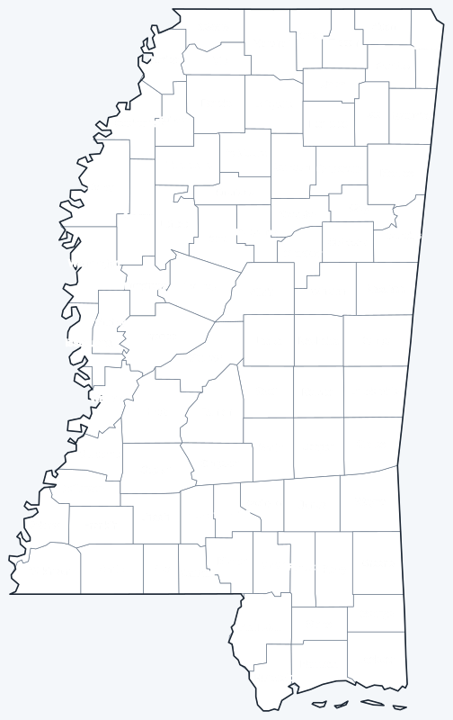
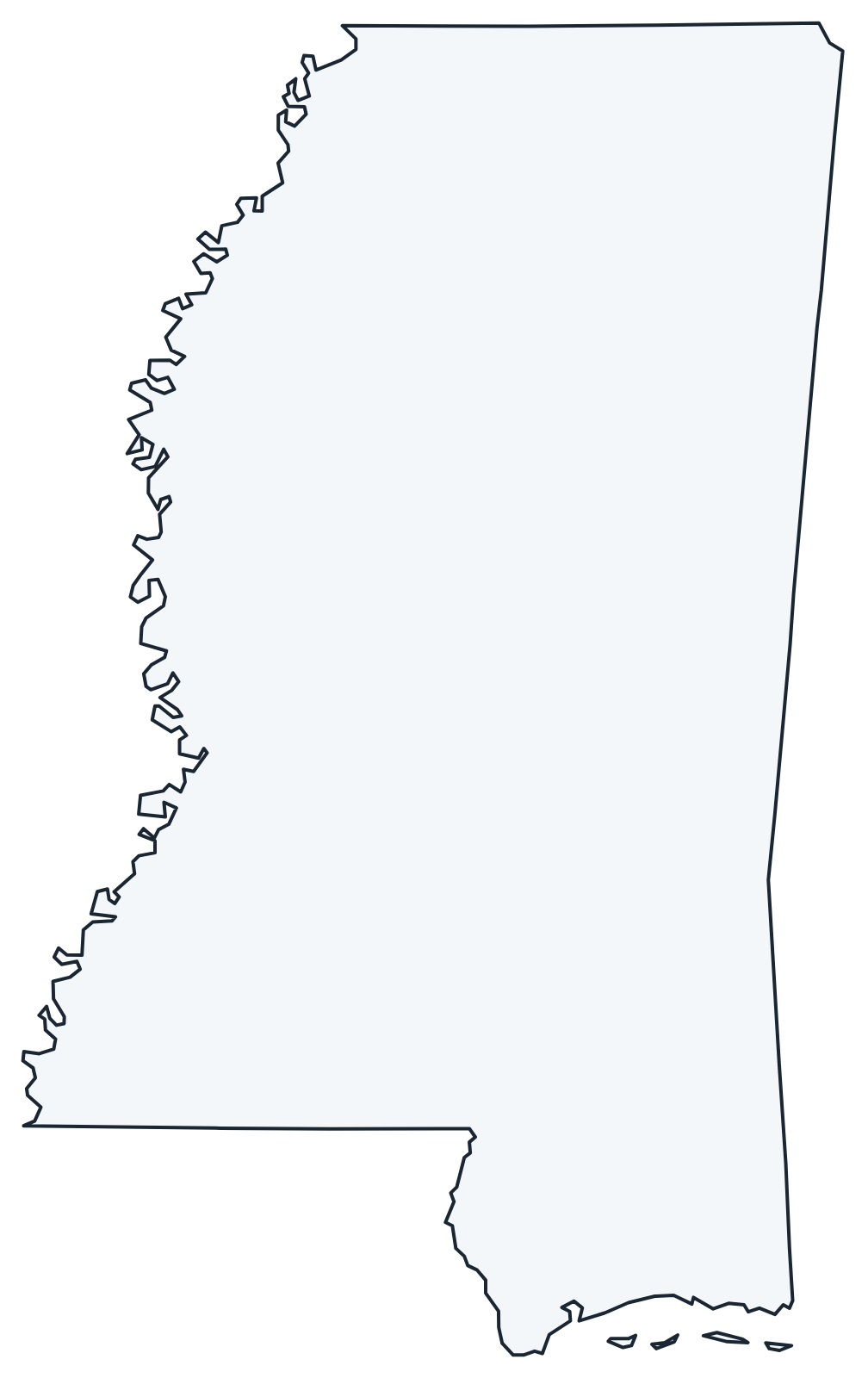
Print the labeled map as a reference or the blank map for county quizzes and coloring; both are SVG files that print sharply at any size.
Frequently asked questions
How many counties are in Mississippi?
Mississippi has 82 counties; 10 of them have two county seats.
What is the largest county in Mississippi?
Yazoo County, with 922.3 sq mi of land. Its seat is Yazoo City.
What is the most populous county in Mississippi?
Hinds County, with 227,742 residents in 2020, or 7.7% of the state.
What county is Jackson in?
Jackson, the state capital, is mainly in Hinds County, with small parts in Madison and Rankin counties. It shares the role of Hinds County seat with Raymond.
More Mississippi and nearby maps
Back to the Mississippi state map for cities, highways and geography.
Neighboring county maps: Alabama county map · Arkansas county map · Louisiana county map · Tennessee county map
Browse all 50 state maps.
Sources: U.S. Census Bureau (2020 Census, 2020 Gazetteer, boundaries); county seats from Wikipedia county lists cross-checked with Wikidata. Last reviewed October 2026.