Maine County Map
Maine has 16 counties. Cumberland County, home to Portland, is the most populous, with 303,069 residents in 2020, and Aroostook County is by far the largest at 6,671.1 sq mi of land. The capital, Augusta, is the seat of Kennebec County.
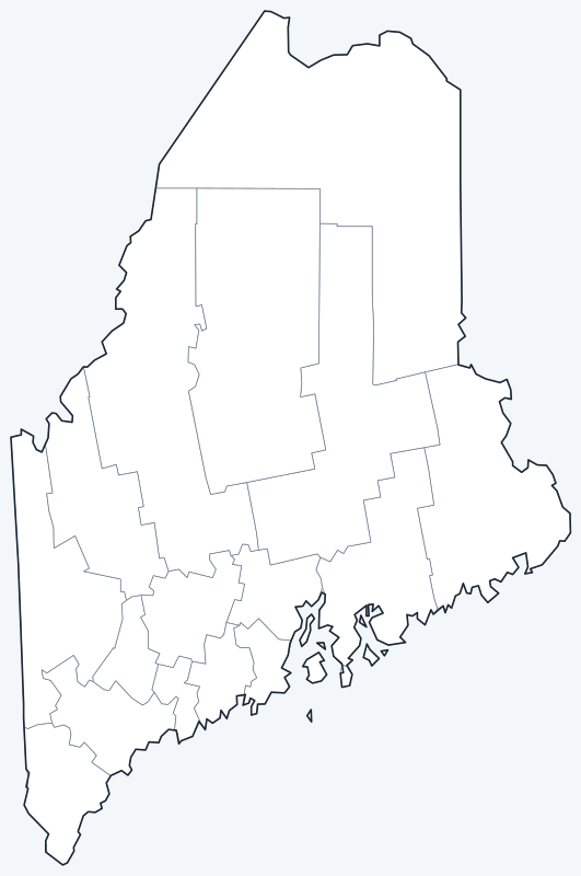
County lines are switched on when the interactive map loads. Hover over a county to see its name, or untick Show counties to hide the lines.
List of Maine counties
| County | County seat | Population (2020) | Land area (sq mi) |
|---|---|---|---|
| Androscoggin | Auburn | 111,139 | 468.0 |
| Aroostook | Houlton | 67,105 | 6,671.1 |
| Cumberland | Portland | 303,069 | 836.2 |
| Franklin | Farmington | 29,456 | 1,697.0 |
| Hancock | Ellsworth | 55,478 | 1,587.1 |
| Kennebec | Augusta | 123,642 | 867.5 |
| Knox | Rockland | 40,607 | 365.1 |
| Lincoln | Wiscasset | 35,237 | 455.9 |
| Oxford | Paris | 57,777 | 2,077.0 |
| Penobscot | Bangor | 152,199 | 3,397.2 |
| Piscataquis | Dover-Foxcroft | 16,800 | 3,960.9 |
| Sagadahoc | Bath | 36,699 | 254.0 |
| Somerset | Skowhegan | 50,477 | 3,924.3 |
| Waldo | Belfast | 39,607 | 730.0 |
| Washington | Machias | 31,095 | 2,562.7 |
| York | Alfred | 211,972 | 991.2 |
Most populous counties
Maine had 1,362,359 residents in the 2020 Census. The five most populous counties hold 66.2% of them:
- Cumberland County (seat: Portland): 303,069 people, 22.2% of the state
- York County (seat: Alfred): 211,972 people, 15.6% of the state
- Penobscot County (seat: Bangor): 152,199 people, 11.2% of the state
- Kennebec County (seat: Augusta): 123,642 people, 9.1% of the state
- Androscoggin County (seat: Auburn): 111,139 people, 8.2% of the state
The least populous county is Piscataquis County, with 16,800 residents.
Largest and smallest counties
By land area, the largest counties are Aroostook County (6,671.1 sq mi), Piscataquis County (3,960.9 sq mi) and Somerset County (3,924.3 sq mi). The smallest are Sagadahoc County (254.0 sq mi), Knox County (365.1 sq mi) and Lincoln County (455.9 sq mi).
Aroostook County is also the largest counting water, at 6,827.4 sq mi in total. The average county covers 1,927.8 sq mi of land.
How counties work in Maine
Maine’s counties have a smaller role than in most states. Most local services, such as schools, roads and zoning, are run by towns and cities. Counties handle functions such as the sheriff’s office, the county jail and the registry of deeds.
Large parts of northern and western Maine are unorganized territory, with no town government. Aroostook County alone covers 21.6% of the state’s land area, yet holds 4.9% of its people.
Printable Maine county maps
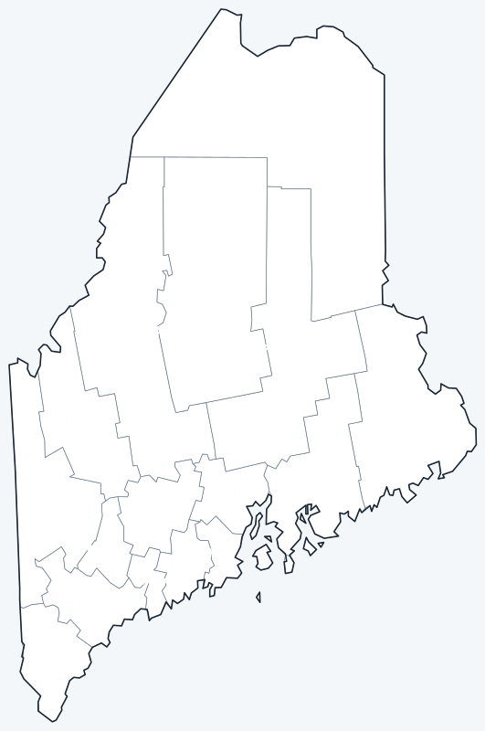
The labeled map shows every county name; the blank version has county lines only, for coloring or quizzes. Both are SVG files that print sharply at any size.
Frequently asked questions
How many counties are in Maine?
Maine has 16 counties. Cumberland County has the most people and Piscataquis County the fewest.
What is the largest county in Maine?
Aroostook County, with 6,671.1 sq mi of land; its seat is Houlton. Piscataquis County (3,960.9 sq mi) is second.
What is the most populous county in Maine?
Cumberland County, with 303,069 people in 2020, or 22.2% of the state. York County is second with 211,972.
What county is Portland, Maine, in?
Portland is in Cumberland County and is its county seat. Augusta, the capital, is the seat of Kennebec County.
Neighboring state county maps
Back to the Maine state map or browse all 50 state maps.
Sources: U.S. Census Bureau (2020 Census, 2020 Gazetteer, boundaries); county seats: Wikidata and Wikipedia county lists. Last reviewed October 2026.