North Dakota County Map
North Dakota has 53 counties. Cass County, whose seat is Fargo, is the most populous with 184,525 residents in 2020, and McKenzie County is the largest by land area at 2,760.1 sq mi. The capital, Bismarck, is the seat of Burleigh County.
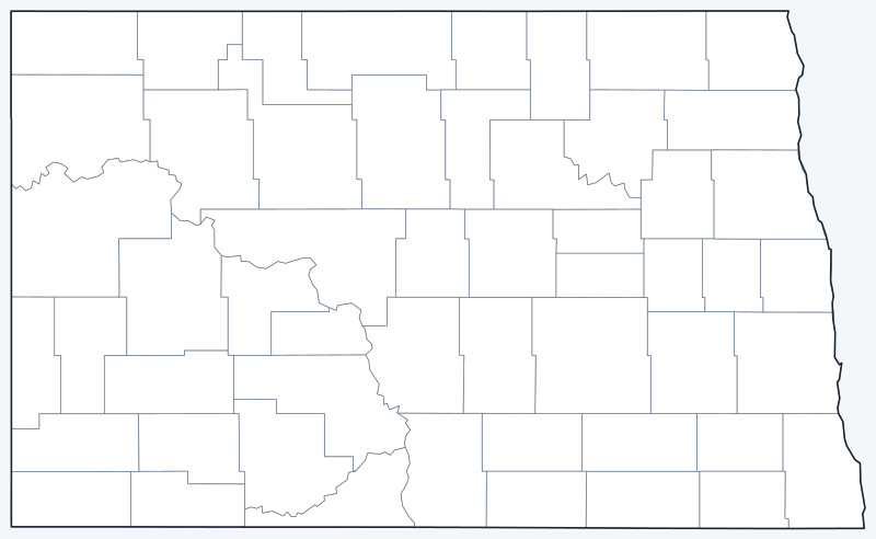
Counties are switched on when the interactive map loads. Hover over a county to see its name, or untick Show counties to hide the county lines.
List of North Dakota counties
All 53 counties in alphabetical order. Click a column heading to sort by seat, population or land area.
| County | County seat | Population (2020) | Land area (sq mi) |
|---|---|---|---|
| Adams County | Hettinger | 2,200 | 987.5 |
| Barnes County | Valley City | 10,853 | 1,491.6 |
| Benson County | Minnewaukan | 5,964 | 1,388.6 |
| Billings County | Medora | 945 | 1,148.5 |
| Bottineau County | Bottineau | 6,379 | 1,668.9 |
| Bowman County | Bowman | 2,993 | 1,161.8 |
| Burke County | Bowbells | 2,201 | 1,103.6 |
| Burleigh County | Bismarck | 98,458 | 1,632.7 |
| Cass County | Fargo | 184,525 | 1,764.9 |
| Cavalier County | Langdon | 3,704 | 1,489.1 |
| Dickey County | Ellendale | 4,999 | 1,131.5 |
| Divide County | Crosby | 2,195 | 1,261.1 |
| Dunn County | Manning | 4,095 | 2,008.5 |
| Eddy County | New Rockford | 2,347 | 630.2 |
| Emmons County | Linton | 3,301 | 1,510.0 |
| Foster County | Carrington | 3,397 | 634.1 |
| Golden Valley County | Beach | 1,736 | 1,000.9 |
| Grand Forks County | Grand Forks | 73,170 | 1,436.2 |
| Grant County | Carson | 2,301 | 1,659.2 |
| Griggs County | Cooperstown | 2,306 | 708.7 |
| Hettinger County | Mott | 2,489 | 1,132.2 |
| Kidder County | Steele | 2,394 | 1,351.1 |
| LaMoure County | LaMoure | 4,093 | 1,146.0 |
| Logan County | Napoleon | 1,876 | 992.6 |
| McHenry County | Towner | 5,345 | 1,873.9 |
| McIntosh County | Ashley | 2,530 | 974.6 |
| McKenzie County | Watford City | 14,704 | 2,760.1 |
| McLean County | Washburn | 9,771 | 2,110.3 |
| Mercer County | Stanton | 8,350 | 1,042.8 |
| Morton County | Mandan | 33,291 | 1,925.9 |
| Mountrail County | Stanley | 9,809 | 1,825.2 |
| Nelson County | Lakota | 3,015 | 981.8 |
| Oliver County | Center | 1,877 | 722.4 |
| Pembina County | Cavalier | 6,844 | 1,118.5 |
| Pierce County | Rugby | 3,990 | 1,018.3 |
| Ramsey County | Devils Lake | 11,605 | 1,185.4 |
| Ransom County | Lisbon | 5,703 | 862.5 |
| Renville County | Mohall | 2,282 | 877.2 |
| Richland County | Wahpeton | 16,529 | 1,435.7 |
| Rolette County | Rolla | 12,187 | 903.0 |
| Sargent County | Forman | 3,862 | 858.5 |
| Sheridan County | McClusky | 1,265 | 972.2 |
| Sioux County | Fort Yates | 3,898 | 1,094.1 |
| Slope County | Amidon | 706 | 1,215.3 |
| Stark County | Dickinson | 33,646 | 1,334.9 |
| Steele County | Finley | 1,798 | 712.1 |
| Stutsman County | Jamestown | 21,593 | 2,221.9 |
| Towner County | Cando | 2,162 | 1,025.1 |
| Traill County | Hillsboro | 7,997 | 861.9 |
| Walsh County | Grafton | 10,563 | 1,281.6 |
| Ward County | Minot | 69,919 | 2,013.0 |
| Wells County | Fessenden | 3,982 | 1,270.5 |
| Williams County | Williston | 40,950 | 2,077.6 |
Most populous counties
The five largest counties by 2020 population hold 59.9% of North Dakota’s 779,094 residents:
- Cass County (seat: Fargo): 184,525 people, 23.7% of the state
- Burleigh County (seat: Bismarck): 98,458 people, 12.6% of the state
- Grand Forks County (seat: Grand Forks): 73,170 people, 9.4% of the state
- Ward County (seat: Minot): 69,919 people, 9.0% of the state
- Williams County (seat: Williston): 40,950 people, 5.3% of the state
The least populous county is Slope County, with 706 people.
Largest and smallest counties
By land area, the largest counties are McKenzie County (2,760.1 sq mi), Stutsman County (2,221.9 sq mi) and McLean County (2,110.3 sq mi). The smallest are Eddy County (630.2 sq mi), Foster County (634.1 sq mi) and Griggs County (708.7 sq mi). Areas exclude water.
How counties work in North Dakota
All 53 counties have a county government and a county seat. Population is concentrated in a few of them: Cass County and Burleigh County together hold 36.3% of the state’s residents, while 30 counties had fewer than 5,000 people in 2020.
Several county seats are small towns. Medora, the seat of Billings County (945 people), is the gateway to the South Unit of Theodore Roosevelt National Park. Watford City, the seat of McKenzie County, is in the Bakken oil region.
Printable North Dakota county maps
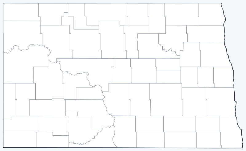
Download the labeled county map for reference or the blank version for coloring and geography practice; both are SVG files that print sharply at any size.
Frequently asked questions
How many counties are in North Dakota?
53. The least populous is Slope County, with 706 people in 2020.
What is the largest county in North Dakota?
McKenzie County, in the western part of the state, with 2,760.1 sq mi of land. Stutsman County (2,221.9 sq mi) is second.
What county is Bismarck in?
Bismarck, the state capital, is the seat of Burleigh County, the second most populous county with 98,458 people in 2020.
What county is Fargo in?
Fargo, the largest city, is the seat of Cass County, home to 23.7% of North Dakota’s population.
More maps
Back to the North Dakota state map. County maps of neighboring states: Minnesota county map · Montana county map · South Dakota county map.
Browse all 50 state maps.
Sources: U.S. Census Bureau (2020 Census, 2020 Gazetteer, boundaries); county seats: Wikipedia and Wikidata county lists. Last reviewed October 2026.