Montana County Map
Montana has 56 counties. Yellowstone County, home to Billings, is the most populous with 164,731 residents in 2020, and Beaverhead County is the largest by land area at 5,542.7 sq mi. The capital, Helena, is the county seat of Lewis and Clark County.
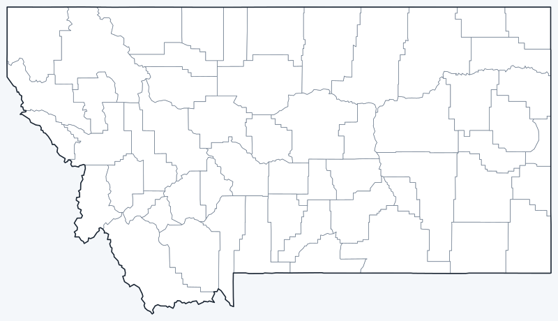
County lines are switched on when the interactive map loads. Hover over a county to see its name, or untick Show counties to hide them and see the cities on the OpenStreetMap base map.
List of Montana counties
| County | County seat | Population (2020) | Land area (sq mi) |
|---|---|---|---|
| Beaverhead County | Dillon | 9,371 | 5,542.7 |
| Big Horn County | Hardin | 13,124 | 4,997.8 |
| Blaine County | Chinook | 7,044 | 4,227.5 |
| Broadwater County | Townsend | 6,774 | 1,192.4 |
| Carbon County | Red Lodge | 10,473 | 2,047.8 |
| Carter County | Ekalaka | 1,415 | 3,340.5 |
| Cascade County | Great Falls | 84,414 | 2,698.2 |
| Chouteau County | Fort Benton | 5,895 | 3,972.5 |
| Custer County | Miles City | 11,867 | 3,783.3 |
| Daniels County | Scobey | 1,661 | 1,426.3 |
| Dawson County | Glendive | 8,940 | 2,371.9 |
| Deer Lodge County | Anaconda | 9,421 | 736.7 |
| Fallon County | Baker | 3,049 | 1,620.6 |
| Fergus County | Lewistown | 11,446 | 4,339.3 |
| Flathead County | Kalispell | 104,357 | 5,087.2 |
| Gallatin County | Bozeman | 118,960 | 2,605.4 |
| Garfield County | Jordan | 1,173 | 4,676.6 |
| Glacier County | Cut Bank | 13,778 | 2,995.1 |
| Golden Valley County | Ryegate | 823 | 1,174.4 |
| Granite County | Philipsburg | 3,309 | 1,727.2 |
| Hill County | Havre | 16,309 | 2,899.4 |
| Jefferson County | Boulder | 12,085 | 1,657.0 |
| Judith Basin County | Stanford | 2,023 | 1,869.7 |
| Lake County | Polson | 31,134 | 1,490.5 |
| Lewis and Clark County | Helena | 70,973 | 3,458.4 |
| Liberty County | Chester | 1,959 | 1,430.0 |
| Lincoln County | Libby | 19,677 | 3,612.6 |
| Madison County | Virginia City | 8,623 | 3,588.2 |
| McCone County | Circle | 1,729 | 2,642.2 |
| Meagher County | White Sulphur Springs | 1,927 | 2,391.9 |
| Mineral County | Superior | 4,535 | 1,219.6 |
| Missoula County | Missoula | 117,922 | 2,593.0 |
| Musselshell County | Roundup | 4,730 | 1,869.0 |
| Park County | Livingston | 17,191 | 2,802.5 |
| Petroleum County | Winnett | 496 | 1,655.6 |
| Phillips County | Malta | 4,217 | 5,140.4 |
| Pondera County | Conrad | 5,898 | 1,624.6 |
| Powder River County | Broadus | 1,694 | 3,298.2 |
| Powell County | Deer Lodge | 6,946 | 2,326.0 |
| Prairie County | Terry | 1,088 | 1,736.6 |
| Ravalli County | Hamilton | 44,174 | 2,391.0 |
| Richland County | Sidney | 11,491 | 2,084.6 |
| Roosevelt County | Wolf Point | 10,794 | 2,354.6 |
| Rosebud County | Forsyth | 8,329 | 5,008.1 |
| Sanders County | Thompson Falls | 12,400 | 2,760.4 |
| Sheridan County | Plentywood | 3,539 | 1,676.9 |
| Silver Bow County | Butte | 35,133 | 718.0 |
| Stillwater County | Columbus | 8,963 | 1,796.7 |
| Sweet Grass County | Big Timber | 3,678 | 1,855.5 |
| Teton County | Choteau | 6,226 | 2,271.6 |
| Toole County | Shelby | 4,971 | 1,914.9 |
| Treasure County | Hysham | 762 | 977.8 |
| Valley County | Glasgow | 7,578 | 4,926.1 |
| Wheatland County | Harlowton | 2,069 | 1,422.5 |
| Wibaux County | Wibaux | 937 | 889.6 |
| Yellowstone County | Billings | 164,731 | 2,633.5 |
Population: 2020 Census. Land area excludes water. Click a column heading to sort.
Most populous counties
The five most populous counties hold 54.5% of Montana’s 1,084,225 residents:
- Yellowstone County (Billings): 164,731, 15.2% of the state
- Gallatin County (Bozeman): 118,960, 11.0% of the state
- Missoula County (Missoula): 117,922, 10.9% of the state
- Flathead County (Kalispell): 104,357, 9.6% of the state
- Cascade County (Great Falls): 84,414, 7.8% of the state
Lewis and Clark County, which contains Helena, ranks sixth with 70,973. At the other end, Petroleum County had only 496 residents, the fewest of any Montana county, followed by Treasure (762) and Golden Valley (823). Of the 56 counties, 22 had fewer than 5,000 people.
Largest and smallest counties
Beaverhead County, in southwestern Montana, is the largest county at 5,542.7 sq mi of land, followed by Phillips County (5,140.4 sq mi) and Flathead County (5,087.2 sq mi). The smallest are Silver Bow County (718.0 sq mi), Deer Lodge County (736.7 sq mi) and Wibaux County (889.6 sq mi).
Consolidated city-counties in Montana
Two of Montana’s smallest counties are run by consolidated city-county governments. Butte-Silver Bow governs Silver Bow County (35,133 people) together with the city of Butte, except for the separately incorporated town of Walkerville. Anaconda-Deer Lodge County combines Deer Lodge County with the city of Anaconda.
Watch the names in this corner of the state: the town of Deer Lodge is the county seat of Powell County, not of Deer Lodge County, whose seat is Anaconda.
Printable Montana county maps
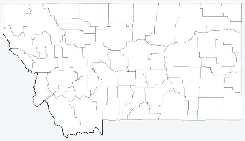
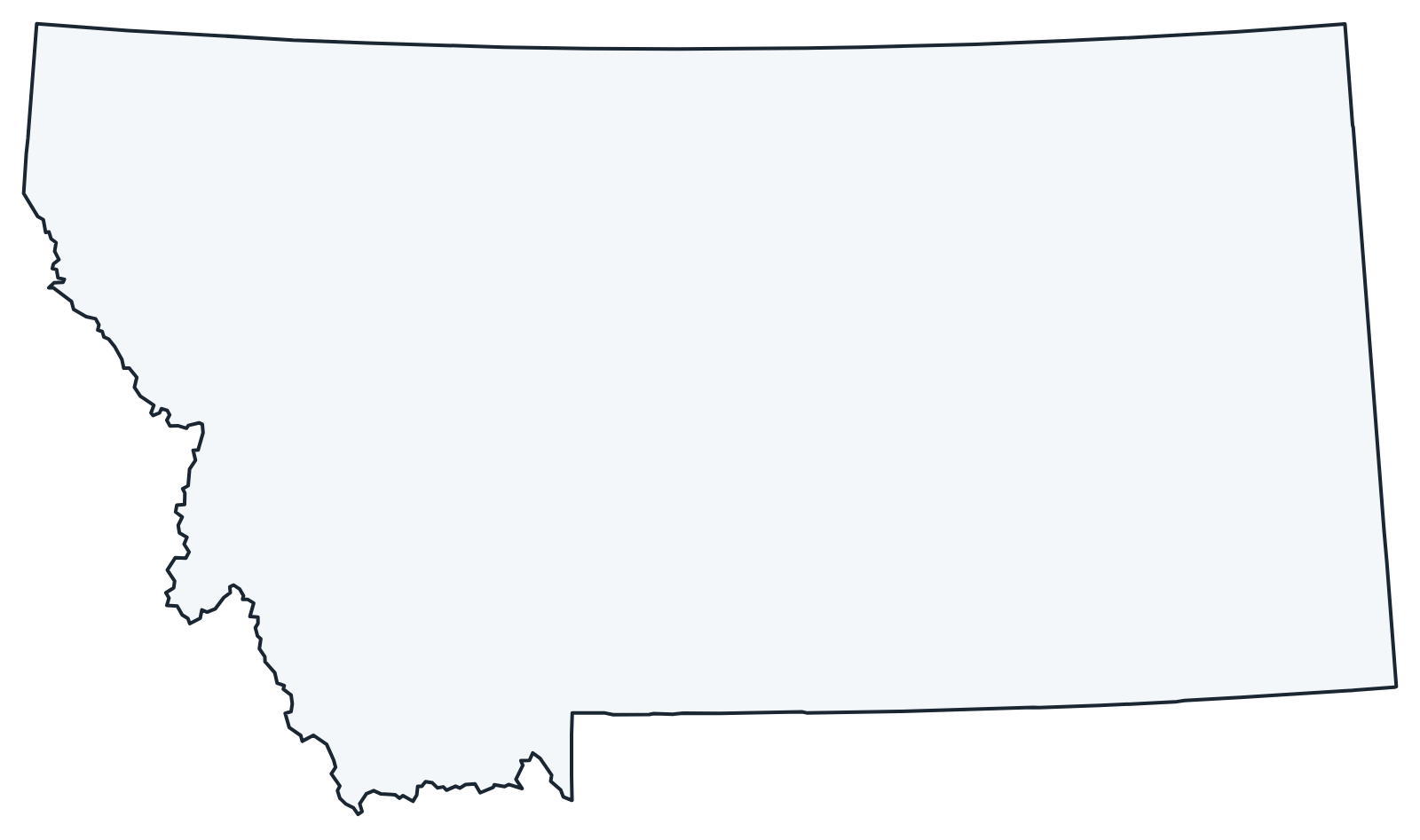
A labeled map with every county name and a blank county outline map for coloring, quizzes or school projects. Free for personal and classroom use.
Frequently asked questions
How many counties are in Montana?
Montana has 56 counties.
What is the largest county in Montana?
Beaverhead County is the largest by land area at 5,542.7 sq mi. Its county seat is Dillon.
What is the most populous county in Montana?
Yellowstone County, with 164,731 residents in 2020. Its county seat, Billings, is Montana’s largest city.
What county is Helena, Montana, in?
Helena is in Lewis and Clark County, and it is the county seat.
More Montana and nearby maps
Back to the Montana state map. County maps of neighboring states: Idaho county map · North Dakota county map · South Dakota county map · Wyoming county map.
Browse all 50 state maps.
Sources: U.S. Census Bureau (2020 Census, 2020 Gazetteer, boundaries); county seats: Wikipedia and Wikidata. Last reviewed October 2026.