Indiana County Map
Indiana has 92 counties. Marion County is the most populous, with 977,203 residents in 2020, and Allen County is the largest by land area at 657.3 sq mi. The capital, Indianapolis, is the seat of Marion County.
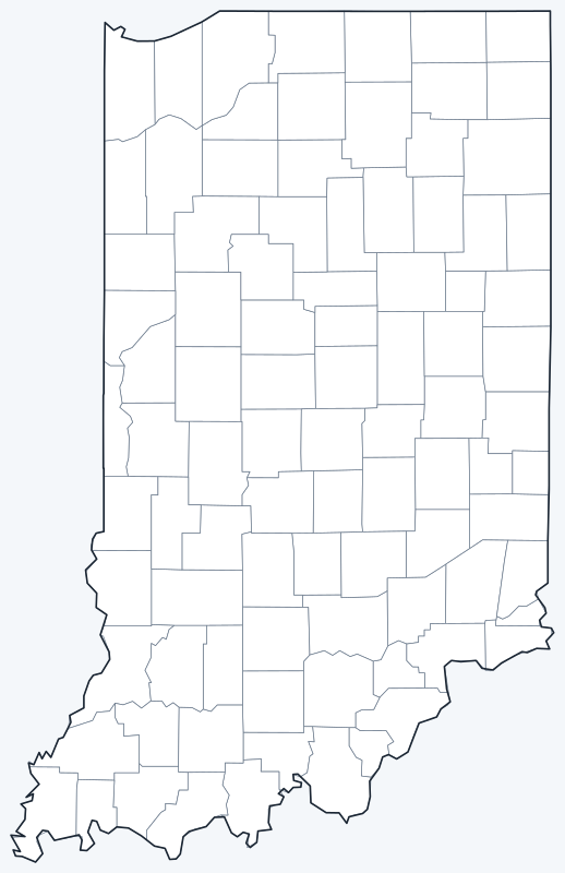
County lines are switched on when the interactive map loads, over an OpenStreetMap base map with major cities (capital in red). Hover over a county to see its name, or untick Show counties to hide the lines.
List of Indiana counties
| County | County seat | Population (2020) | Land area (sq mi) |
|---|---|---|---|
| Adams County | Decatur | 35,809 | 338.9 |
| Allen County | Fort Wayne | 385,410 | 657.3 |
| Bartholomew County | Columbus | 82,208 | 406.9 |
| Benton County | Fowler | 8,719 | 406.4 |
| Blackford County | Hartford City | 12,112 | 165.1 |
| Boone County | Lebanon | 70,812 | 422.9 |
| Brown County | Nashville | 15,475 | 312.0 |
| Carroll County | Delphi | 20,306 | 372.2 |
| Cass County | Logansport | 37,870 | 412.1 |
| Clark County | Jeffersonville | 121,093 | 372.8 |
| Clay County | Brazil | 26,466 | 357.6 |
| Clinton County | Frankfort | 33,190 | 405.1 |
| Crawford County | English | 10,526 | 305.6 |
| Daviess County | Washington | 33,381 | 429.5 |
| DeKalb County | Auburn | 43,265 | 362.8 |
| Dearborn County | Lawrenceburg | 50,679 | 305.1 |
| Decatur County | Greensburg | 26,472 | 372.6 |
| Delaware County | Muncie | 111,903 | 392.1 |
| Dubois County | Jasper | 43,637 | 427.3 |
| Elkhart County | Goshen | 207,047 | 463.2 |
| Fayette County | Connersville | 23,398 | 215.0 |
| Floyd County | New Albany | 80,484 | 148.5 |
| Fountain County | Covington | 16,479 | 395.7 |
| Franklin County | Brookville | 22,785 | 384.4 |
| Fulton County | Rochester | 20,480 | 368.4 |
| Gibson County | Princeton | 33,011 | 487.4 |
| Grant County | Marion | 66,674 | 414.1 |
| Greene County | Bloomfield | 30,803 | 542.5 |
| Hamilton County | Noblesville | 347,467 | 394.4 |
| Hancock County | Greenfield | 79,840 | 306.0 |
| Harrison County | Corydon | 39,654 | 484.1 |
| Hendricks County | Danville | 174,788 | 406.9 |
| Henry County | New Castle | 48,914 | 391.9 |
| Howard County | Kokomo | 83,658 | 293.1 |
| Huntington County | Huntington | 36,662 | 382.6 |
| Jackson County | Brownstown | 46,428 | 510.0 |
| Jasper County | Rensselaer | 32,918 | 559.7 |
| Jay County | Portland | 20,478 | 383.9 |
| Jefferson County | Madison | 33,147 | 360.6 |
| Jennings County | Vernon | 27,613 | 376.6 |
| Johnson County | Franklin | 161,765 | 320.4 |
| Knox County | Vincennes | 36,282 | 515.8 |
| Kosciusko County | Warsaw | 80,240 | 531.4 |
| LaGrange County | LaGrange | 40,446 | 379.6 |
| LaPorte County | La Porte | 112,417 | 598.3 |
| Lake County | Crown Point | 498,700 | 498.7 |
| Lawrence County | Bedford | 45,011 | 449.1 |
| Madison County | Anderson | 130,129 | 451.9 |
| Marion County | Indianapolis | 977,203 | 396.6 |
| Marshall County | Plymouth | 46,095 | 443.6 |
| Martin County | Shoals | 9,812 | 335.8 |
| Miami County | Peru | 35,962 | 373.8 |
| Monroe County | Bloomington | 139,718 | 394.5 |
| Montgomery County | Crawfordsville | 37,936 | 504.6 |
| Morgan County | Martinsville | 71,780 | 403.8 |
| Newton County | Kentland | 13,830 | 401.8 |
| Noble County | Albion | 47,457 | 410.8 |
| Ohio County | Rising Sun | 5,940 | 86.1 |
| Orange County | Paoli | 19,867 | 398.4 |
| Owen County | Spencer | 21,321 | 385.3 |
| Parke County | Rockville | 16,156 | 444.7 |
| Perry County | Tell City | 19,170 | 381.7 |
| Pike County | Petersburg | 12,250 | 334.3 |
| Porter County | Valparaiso | 173,215 | 418.1 |
| Posey County | Mount Vernon | 25,222 | 409.4 |
| Pulaski County | Winamac | 12,514 | 433.7 |
| Putnam County | Greencastle | 36,726 | 480.5 |
| Randolph County | Winchester | 24,502 | 452.4 |
| Ripley County | Versailles | 28,995 | 446.4 |
| Rush County | Rushville | 16,752 | 408.1 |
| Scott County | Scottsburg | 24,384 | 190.4 |
| Shelby County | Shelbyville | 45,055 | 411.1 |
| Spencer County | Rockport | 19,810 | 396.9 |
| St. Joseph County | South Bend | 272,912 | 457.8 |
| Starke County | Knox | 23,371 | 309.1 |
| Steuben County | Angola | 34,435 | 308.8 |
| Sullivan County | Sullivan | 20,817 | 447.2 |
| Switzerland County | Vevay | 9,737 | 220.7 |
| Tippecanoe County | Lafayette | 186,251 | 498.9 |
| Tipton County | Tipton | 15,359 | 260.5 |
| Union County | Liberty | 7,087 | 161.2 |
| Vanderburgh County | Evansville | 180,136 | 233.4 |
| Vermillion County | Newport | 15,439 | 256.9 |
| Vigo County | Terre Haute | 106,153 | 403.6 |
| Wabash County | Wabash | 30,976 | 412.5 |
| Warren County | Williamsport | 8,440 | 364.7 |
| Warrick County | Boonville | 63,898 | 384.8 |
| Washington County | Salem | 28,182 | 513.7 |
| Wayne County | Richmond | 66,553 | 401.8 |
| Wells County | Bluffton | 28,180 | 368.1 |
| White County | Monticello | 24,688 | 505.1 |
| Whitley County | Columbia City | 34,191 | 335.6 |
Click a column heading to sort. Land area excludes water.
Most populous counties
Indiana had 6,785,528 residents in the 2020 Census. The five most populous counties held 36.6 percent of them:
- Marion County (seat Indianapolis): 977,203, or 14.4 percent of the state
- Lake County (seat Crown Point): 498,700, or 7.3 percent of the state
- Allen County (seat Fort Wayne): 385,410, or 5.7 percent of the state
- Hamilton County (seat Noblesville): 347,467, or 5.1 percent of the state
- St. Joseph County (seat South Bend): 272,912, or 4.0 percent of the state
The least populous is Ohio County, with 5,940 residents. The median Indiana county had 34,435 people in 2020.
Largest and smallest counties
By land area, the largest Indiana counties are Allen County (657.3 sq mi), LaPorte County (598.3 sq mi) and Jasper County (559.7 sq mi). The smallest are Ohio County (86.1 sq mi), Floyd County (148.5 sq mi) and Union County (161.2 sq mi).
The average Indiana county covers 389.4 sq mi of land. Allen County is 7.6 times the land area of Ohio County.
How counties work in Indiana
Indianapolis and Marion County have been consolidated since 1970 under a system known as Unigov, so the city and county share one mayor and one City-County Council. A few towns inside the county, including Beech Grove, Lawrence, Southport and Speedway, kept their own city or town governments.
Every Indiana county is divided into civil townships, each led by an elected township trustee whose duties include emergency poor relief.
Allen County, the largest by land area, is in northeastern Indiana around Fort Wayne.
Printable Indiana county maps
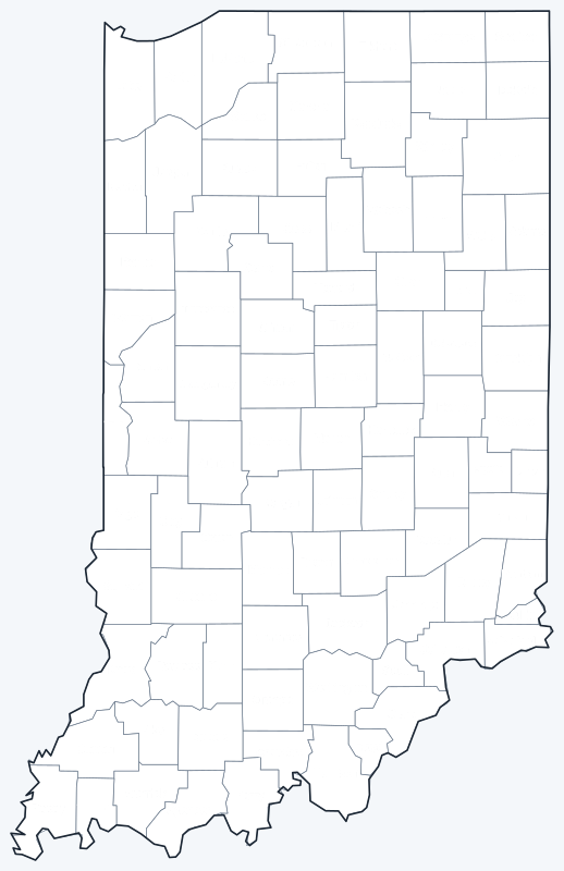
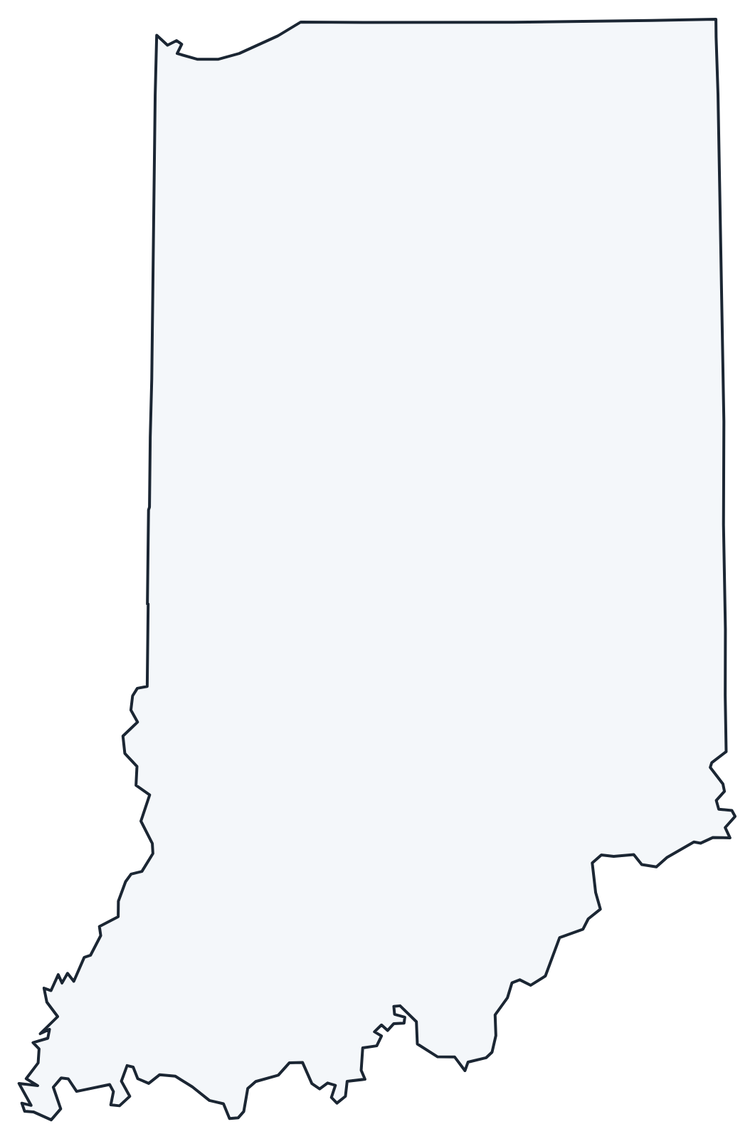
Download the labeled map with every county name, or the blank county map for quizzes and coloring; both are SVG files that print sharply at any size and are free for personal and classroom use.
Frequently asked questions
How many counties are in Indiana?
Indiana has 92 counties. Marion County has the most people and Ohio County the fewest.
What is the largest county in Indiana?
Allen County, with 657.3 sq mi of land. Its seat is Fort Wayne.
What is the most populous county in Indiana?
Marion County, with 977,203 residents in the 2020 Census, 14.4 percent of the state total.
What county is Indianapolis in?
Marion County. The city and county governments have been consolidated since 1970, and Indianapolis is the county seat.
More Indiana and county maps
See the Indiana state map for cities, geography and highways.
County maps of neighboring states: Illinois · Kentucky · Michigan · Ohio
Browse all 50 state maps.
Sources: U.S. Census Bureau (2020 Census, 2020 Gazetteer, boundaries); county seats from Wikipedia county lists cross-checked with Wikidata. Last reviewed October 2026.