Michigan County Map
Michigan has 83 counties. Wayne County, home to Detroit, is the most populous with 1,793,561 residents in 2020, and Marquette County in the Upper Peninsula is the largest by land area at 1,809.1 sq mi. Lansing, the capital, lies mostly in Ingham County, whose seat is Mason.
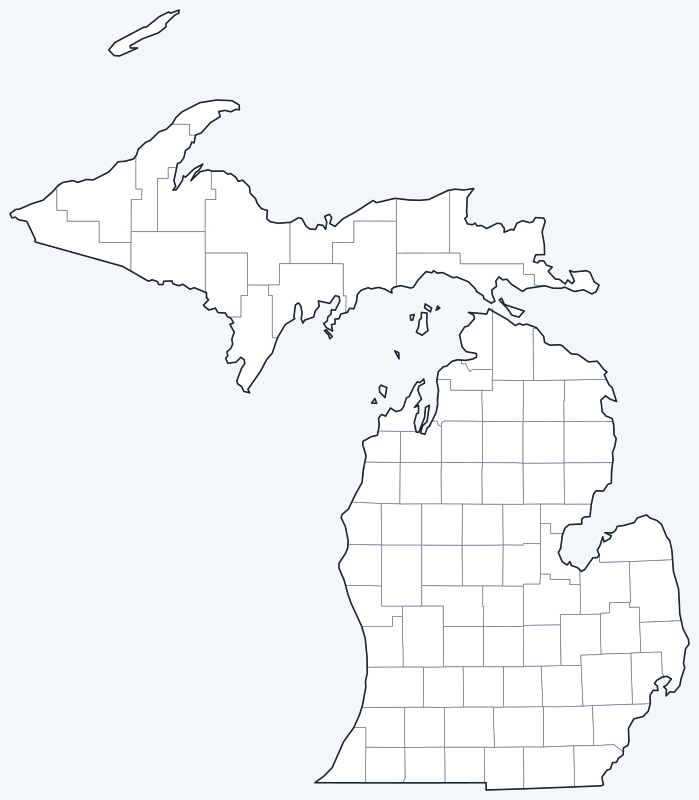
County lines are switched on when the interactive map loads. Hover over a county to see its name, or untick Show counties to hide them.
List of Michigan counties
| County | County seat | Population (2020) | Land area (sq mi) |
|---|---|---|---|
| Alcona County | Harrisville | 10,167 | 674.7 |
| Alger County | Munising | 8,842 | 915.0 |
| Allegan County | Allegan | 120,502 | 825.3 |
| Alpena County | Alpena | 28,907 | 571.9 |
| Antrim County | Bellaire | 23,431 | 475.7 |
| Arenac County | Standish | 15,002 | 363.2 |
| Baraga County | L'Anse | 8,158 | 898.4 |
| Barry County | Hastings | 62,423 | 553.1 |
| Bay County | Bay City | 103,856 | 442.4 |
| Benzie County | Beulah | 17,970 | 319.7 |
| Berrien County | St. Joseph | 154,316 | 567.8 |
| Branch County | Coldwater | 44,862 | 506.4 |
| Calhoun County | Marshall | 134,310 | 706.3 |
| Cass County | Cassopolis | 51,589 | 490.1 |
| Charlevoix County | Charlevoix | 26,054 | 416.3 |
| Cheboygan County | Cheboygan | 25,579 | 715.3 |
| Chippewa County | Sault Ste. Marie | 36,785 | 1,558.5 |
| Clare County | Harrison | 30,856 | 564.4 |
| Clinton County | St. Johns | 79,128 | 566.3 |
| Crawford County | Grayling | 12,988 | 556.4 |
| Delta County | Escanaba | 36,903 | 1,171.1 |
| Dickinson County | Iron Mountain | 25,947 | 760.9 |
| Eaton County | Charlotte | 109,175 | 575.2 |
| Emmet County | Petoskey | 34,112 | 467.5 |
| Genesee County | Flint | 406,211 | 636.9 |
| Gladwin County | Gladwin | 25,386 | 501.8 |
| Gogebic County | Bessemer | 14,380 | 1,102.1 |
| Grand Traverse County | Traverse City | 95,238 | 464.3 |
| Gratiot County | Ithaca | 41,761 | 568.4 |
| Hillsdale County | Hillsdale | 45,746 | 598.2 |
| Houghton County | Houghton | 37,361 | 1,009.1 |
| Huron County | Bad Axe | 31,407 | 836.0 |
| Ingham County | Mason | 284,900 | 556.1 |
| Ionia County | Ionia | 66,804 | 571.3 |
| Iosco County | Tawas City | 25,237 | 549.1 |
| Iron County | Crystal Falls | 11,631 | 1,166.0 |
| Isabella County | Mount Pleasant | 64,394 | 572.7 |
| Jackson County | Jackson | 160,366 | 701.9 |
| Kalamazoo County | Kalamazoo | 261,670 | 562.0 |
| Kalkaska County | Kalkaska | 17,939 | 559.7 |
| Kent County | Grand Rapids | 657,974 | 848.9 |
| Keweenaw County | Eagle River | 2,046 | 540.1 |
| Lake County | Baldwin | 12,096 | 567.6 |
| Lapeer County | Lapeer | 88,619 | 647.0 |
| Leelanau County | Suttons Bay Township | 22,301 | 347.2 |
| Lenawee County | Adrian | 99,423 | 749.6 |
| Livingston County | Howell | 193,866 | 565.3 |
| Luce County | Newberry | 5,339 | 899.1 |
| Mackinac County | St. Ignace | 10,834 | 1,021.9 |
| Macomb County | Mount Clemens | 881,217 | 479.3 |
| Manistee County | Manistee | 25,032 | 542.3 |
| Marquette County | Marquette | 66,017 | 1,809.1 |
| Mason County | Ludington | 29,052 | 495.0 |
| Mecosta County | Big Rapids | 39,714 | 555.2 |
| Menominee County | Menominee | 23,502 | 1,044.0 |
| Midland County | Midland | 83,494 | 517.4 |
| Missaukee County | Lake City | 15,052 | 564.8 |
| Monroe County | Monroe | 154,809 | 549.4 |
| Montcalm County | Stanton | 66,614 | 705.3 |
| Montmorency County | Atlanta | 9,153 | 546.7 |
| Muskegon County | Muskegon | 175,824 | 503.9 |
| Newaygo County | White Cloud | 49,978 | 838.9 |
| Oakland County | Pontiac | 1,274,395 | 867.3 |
| Oceana County | Hart | 26,659 | 538.1 |
| Ogemaw County | West Branch | 20,770 | 563.5 |
| Ontonagon County | Ontonagon | 5,816 | 1,311.0 |
| Osceola County | Reed City | 22,891 | 566.3 |
| Oscoda County | Mio | 8,219 | 565.7 |
| Otsego County | Gaylord | 25,091 | 515.0 |
| Ottawa County | Grand Haven | 296,200 | 563.5 |
| Presque Isle County | Rogers City | 12,982 | 658.7 |
| Roscommon County | Roscommon | 23,459 | 519.9 |
| Saginaw County | Saginaw | 190,124 | 800.8 |
| Sanilac County | Sandusky | 40,611 | 962.6 |
| Schoolcraft County | Manistique | 8,047 | 1,171.9 |
| Shiawassee County | Corunna | 68,094 | 531.0 |
| St. Clair County | Port Huron | 160,383 | 721.5 |
| St. Joseph County | Centreville | 60,939 | 500.6 |
| Tuscola County | Caro | 53,323 | 804.9 |
| Van Buren County | Paw Paw | 75,587 | 607.8 |
| Washtenaw County | Ann Arbor | 372,258 | 706.0 |
| Wayne County | Detroit | 1,793,561 | 611.8 |
| Wexford County | Cadillac | 33,673 | 564.9 |
Most populous counties
The five most populous counties are home to 49.7% of Michigan’s 10,077,331 residents (2020 Census).
- Wayne County (Detroit): 1,793,561, 17.8% of the state
- Oakland County (Pontiac): 1,274,395, 12.6% of the state
- Macomb County (Mount Clemens): 881,217, 8.7% of the state
- Kent County (Grand Rapids): 657,974, 6.5% of the state
- Genesee County (Flint): 406,211, 4.0% of the state
The three Detroit-area counties (Wayne, Oakland and Macomb) alone account for 39.2% of Michigan’s population. At the other end, Keweenaw County at the tip of the Keweenaw Peninsula had just 2,046 residents.
Largest and smallest counties
Marquette County is the largest county at 1,809.1 sq mi of land, followed by Chippewa County (1,558.5 sq mi) and Ontonagon County (1,311.0 sq mi). Benzie County, on Lake Michigan in the northwestern Lower Peninsula, is the smallest at 319.7 sq mi. Because counties extend into the Great Lakes, many have far more total area than land: Keweenaw County covers 5,966.3 sq mi in total but only 540.1 sq mi of land.
Counties in the two peninsulas
Michigan’s counties are split between its two peninsulas: 15 in the Upper Peninsula and the rest in the Lower Peninsula. Counties are divided into townships and cities, and each county has an elected board of commissioners.
Michigan uses two time zones by county: Gogebic, Iron, Dickinson and Menominee counties, along the Wisconsin border, use Central Time; the rest of the state uses Eastern Time.
Printable Michigan county maps
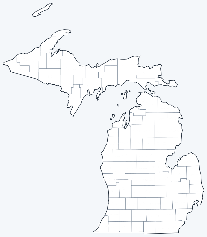
Print the labeled map as a reference or the blank map for county quizzes and coloring; both are SVG files that print sharply at any size.
Frequently asked questions
How many counties are in Michigan?
Michigan has 83 counties, 15 of them in the Upper Peninsula.
What is the largest county in Michigan?
Marquette County, with 1,809.1 sq mi of land. Its seat is Marquette.
What is the most populous county in Michigan?
Wayne County, with 1,793,561 residents in 2020. Its seat is Detroit.
What county is Lansing in?
Lansing, the state capital, is mostly in Ingham County. The Ingham County seat is Mason, not Lansing.
More Michigan and nearby maps
Back to the Michigan state map for cities, highways and geography.
Neighboring county maps: Indiana county map · Ohio county map · Wisconsin county map · Illinois county map · Minnesota county map
Browse all 50 state maps.
Sources: U.S. Census Bureau (2020 Census, 2020 Gazetteer, boundaries); county seats from Wikipedia county lists cross-checked with Wikidata. Last reviewed October 2026.