Illinois County Map
Illinois has 102 counties. Cook County is the most populous, with 5,275,541 residents in 2020, and McLean County is the largest by land area at 1,183.2 sq mi. The capital, Springfield, is the seat of Sangamon County.
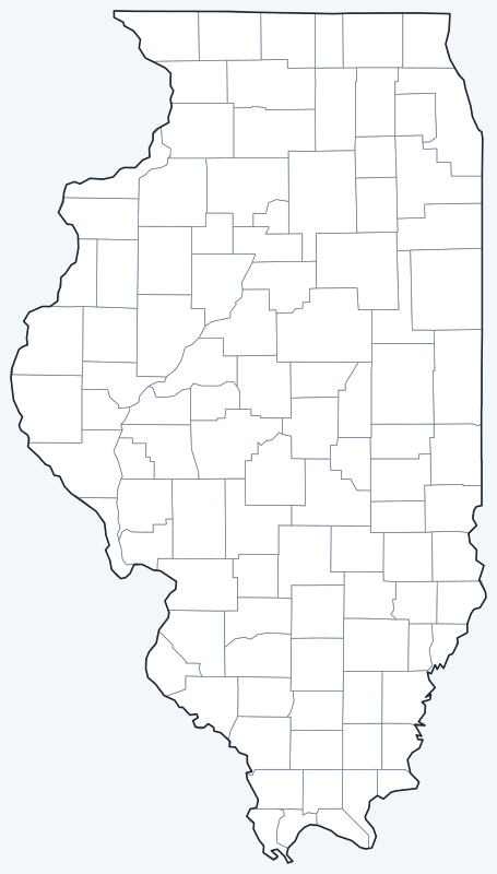
County lines are switched on when the interactive map loads, over an OpenStreetMap base map with major cities (capital in red). Hover over a county to see its name, or untick Show counties to hide the lines.
List of Illinois counties
| County | County seat | Population (2020) | Land area (sq mi) |
|---|---|---|---|
| Adams County | Quincy | 65,737 | 855.1 |
| Alexander County | Cairo | 5,240 | 235.4 |
| Bond County | Greenville | 16,725 | 380.3 |
| Boone County | Belvidere | 53,448 | 280.7 |
| Brown County | Mount Sterling | 6,244 | 305.7 |
| Bureau County | Princeton | 33,244 | 869.1 |
| Calhoun County | Hardin | 4,437 | 253.8 |
| Carroll County | Mount Carroll | 15,702 | 445.4 |
| Cass County | Virginia | 13,042 | 375.8 |
| Champaign County | Urbana | 205,865 | 996.1 |
| Christian County | Taylorville | 34,032 | 709.5 |
| Clark County | Marshall | 15,455 | 501.4 |
| Clay County | Louisville | 13,288 | 468.4 |
| Clinton County | Carlyle | 36,899 | 473.9 |
| Coles County | Charleston | 46,863 | 508.3 |
| Cook County | Chicago | 5,275,541 | 944.9 |
| Crawford County | Robinson | 18,679 | 443.6 |
| Cumberland County | Toledo | 10,450 | 345.9 |
| De Witt County | Clinton | 15,516 | 397.6 |
| DeKalb County | Sycamore | 100,420 | 631.3 |
| Douglas County | Tuscola | 19,740 | 416.6 |
| DuPage County | Wheaton | 932,877 | 327.8 |
| Edgar County | Paris | 16,866 | 623.3 |
| Edwards County | Albion | 6,245 | 222.4 |
| Effingham County | Effingham | 34,668 | 478.8 |
| Fayette County | Vandalia | 21,488 | 716.4 |
| Ford County | Paxton | 13,534 | 485.6 |
| Franklin County | Benton | 37,804 | 408.9 |
| Fulton County | Lewistown | 33,609 | 865.7 |
| Gallatin County | Shawneetown | 4,946 | 322.9 |
| Greene County | Carrollton | 11,985 | 543.0 |
| Grundy County | Morris | 52,533 | 418.1 |
| Hamilton County | McLeansboro | 7,993 | 434.6 |
| Hancock County | Carthage | 17,620 | 793.7 |
| Hardin County | Elizabethtown | 3,649 | 177.4 |
| Henderson County | Oquawka | 6,387 | 378.8 |
| Henry County | Cambridge | 49,284 | 823.1 |
| Iroquois County | Watseka | 27,077 | 1,117.4 |
| Jackson County | Murphysboro | 52,974 | 583.6 |
| Jasper County | Newton | 9,287 | 494.6 |
| Jefferson County | Mount Vernon | 37,113 | 571.2 |
| Jersey County | Jerseyville | 21,512 | 369.7 |
| Jo Daviess County | Galena | 22,035 | 600.9 |
| Johnson County | Vienna | 13,308 | 343.7 |
| Kane County | Geneva | 516,522 | 519.4 |
| Kankakee County | Kankakee | 107,502 | 676.5 |
| Kendall County | Yorkville | 131,869 | 320.2 |
| Knox County | Galesburg | 49,967 | 716.4 |
| LaSalle County | Ottawa | 109,658 | 1,135.2 |
| Lake County | Waukegan | 714,342 | 443.6 |
| Lawrence County | Lawrenceville | 15,280 | 372.2 |
| Lee County | Dixon | 34,145 | 724.8 |
| Livingston County | Pontiac | 35,815 | 1,043.6 |
| Logan County | Lincoln | 27,987 | 618.1 |
| Macon County | Decatur | 103,998 | 580.6 |
| Macoupin County | Carlinville | 44,967 | 863.0 |
| Madison County | Edwardsville | 265,859 | 715.5 |
| Marion County | Salem | 37,729 | 572.5 |
| Marshall County | Lacon | 11,742 | 386.8 |
| Mason County | Havana | 13,086 | 539.4 |
| Massac County | Metropolis | 14,169 | 237.2 |
| McDonough County | Macomb | 27,238 | 589.3 |
| McHenry County | Woodstock | 310,229 | 603.4 |
| McLean County | Bloomington | 170,954 | 1,183.2 |
| Menard County | Petersburg | 12,297 | 314.4 |
| Mercer County | Aledo | 15,699 | 561.2 |
| Monroe County | Waterloo | 34,962 | 385.3 |
| Montgomery County | Hillsboro | 28,288 | 703.8 |
| Morgan County | Jacksonville | 32,915 | 568.9 |
| Moultrie County | Sullivan | 14,526 | 336.0 |
| Ogle County | Oregon | 51,788 | 758.7 |
| Peoria County | Peoria | 181,830 | 618.7 |
| Perry County | Pinckneyville | 20,945 | 441.9 |
| Piatt County | Monticello | 16,673 | 439.2 |
| Pike County | Pittsfield | 14,739 | 831.4 |
| Pope County | Golconda | 3,763 | 368.9 |
| Pulaski County | Mound City | 5,193 | 199.3 |
| Putnam County | Hennepin | 5,637 | 160.1 |
| Randolph County | Chester | 30,163 | 575.4 |
| Richland County | Olney | 15,813 | 360.0 |
| Rock Island County | Rock Island | 144,672 | 427.5 |
| Saline County | Harrisburg | 23,768 | 380.0 |
| Sangamon County | Springfield | 196,343 | 868.3 |
| Schuyler County | Rushville | 6,902 | 437.3 |
| Scott County | Winchester | 4,949 | 250.8 |
| Shelby County | Shelbyville | 20,990 | 758.5 |
| St. Clair County | Belleville | 257,400 | 657.7 |
| Stark County | Toulon | 5,400 | 288.1 |
| Stephenson County | Freeport | 44,630 | 564.2 |
| Tazewell County | Pekin | 131,343 | 646.5 |
| Union County | Jonesboro | 17,244 | 413.4 |
| Vermilion County | Danville | 74,188 | 898.3 |
| Wabash County | Mount Carmel | 11,361 | 223.3 |
| Warren County | Monmouth | 16,835 | 542.4 |
| Washington County | Nashville | 13,761 | 562.6 |
| Wayne County | Fairfield | 16,179 | 713.8 |
| White County | Carmi | 13,877 | 495.0 |
| Whiteside County | Morrison | 55,691 | 684.1 |
| Will County | Joliet | 696,355 | 835.9 |
| Williamson County | Marion | 67,153 | 420.2 |
| Winnebago County | Rockford | 285,350 | 513.0 |
| Woodford County | Eureka | 38,467 | 527.5 |
Click a column heading to sort. Land area excludes water.
Most populous counties
Illinois had 12,812,508 residents in the 2020 Census. The five most populous counties held 63.5 percent of them:
- Cook County (seat Chicago): 5,275,541, or 41.2 percent of the state
- DuPage County (seat Wheaton): 932,877, or 7.3 percent of the state
- Lake County (seat Waukegan): 714,342, or 5.6 percent of the state
- Will County (seat Joliet): 696,355, or 5.4 percent of the state
- Kane County (seat Geneva): 516,522, or 4.0 percent of the state
The least populous is Hardin County, with 3,649 residents. The median Illinois county had 27,077 people in 2020.
Largest and smallest counties
By land area, the largest Illinois counties are McLean County (1,183.2 sq mi), LaSalle County (1,135.2 sq mi) and Iroquois County (1,117.4 sq mi). The smallest are Putnam County (160.1 sq mi), Hardin County (177.4 sq mi) and Pulaski County (199.3 sq mi).
The average Illinois county covers 544.2 sq mi of land. McLean County is 7.4 times the land area of Putnam County.
How counties work in Illinois
Cook County, seat Chicago, is the second most populous county in the United States after Los Angeles County. Chicago lies almost entirely in Cook County; a small part of the city around O’Hare International Airport extends into DuPage County.
Most Illinois counties are divided into civil townships, which handle local services such as township roads and property assessment; the remaining counties have no townships and are run by a board of county commissioners.
The collar counties around Cook (DuPage, Kane, Lake, McHenry and Will) are the main suburban counties around Chicago. The state capital, Springfield, is the seat of Sangamon County in central Illinois.
Printable Illinois county maps
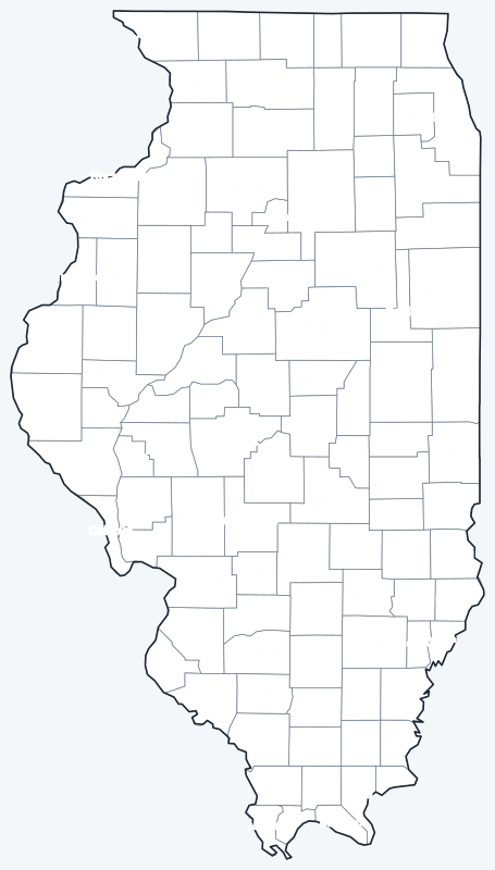
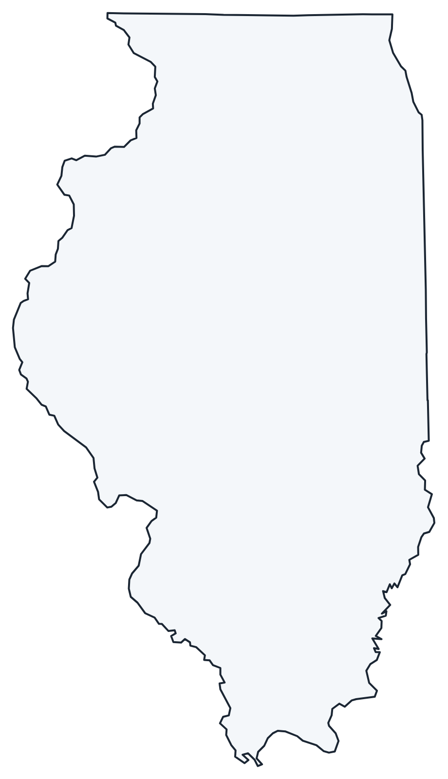
Download the labeled map with every county name, or the blank county map for quizzes and coloring; both are SVG files that print sharply at any size and are free for personal and classroom use.
Frequently asked questions
How many counties are in Illinois?
Illinois has 102 counties. Cook County has the most people and Hardin County the fewest.
What is the largest county in Illinois?
McLean County, with 1,183.2 sq mi of land. Its seat is Bloomington.
What is the most populous county in Illinois?
Cook County, with 5,275,541 residents in the 2020 Census, 41.2 percent of the state total.
What county is Chicago in?
Cook County, where Chicago is the county seat. A small part of the city near O’Hare International Airport is in DuPage County.
More Illinois and county maps
See the Illinois state map for cities, geography and highways.
County maps of neighboring states: Indiana · Iowa · Kentucky · Missouri · Wisconsin
Browse all 50 state maps.
Sources: U.S. Census Bureau (2020 Census, 2020 Gazetteer, boundaries); county seats from Wikipedia county lists cross-checked with Wikidata. Last reviewed October 2026.