Wisconsin County Map
Wisconsin has 72 counties. Milwaukee County is the most populous, with 939,489 people in 2020, and Marathon County is the largest by land area at 1,545.2 sq mi. The capital, Madison, is the seat of Dane County.
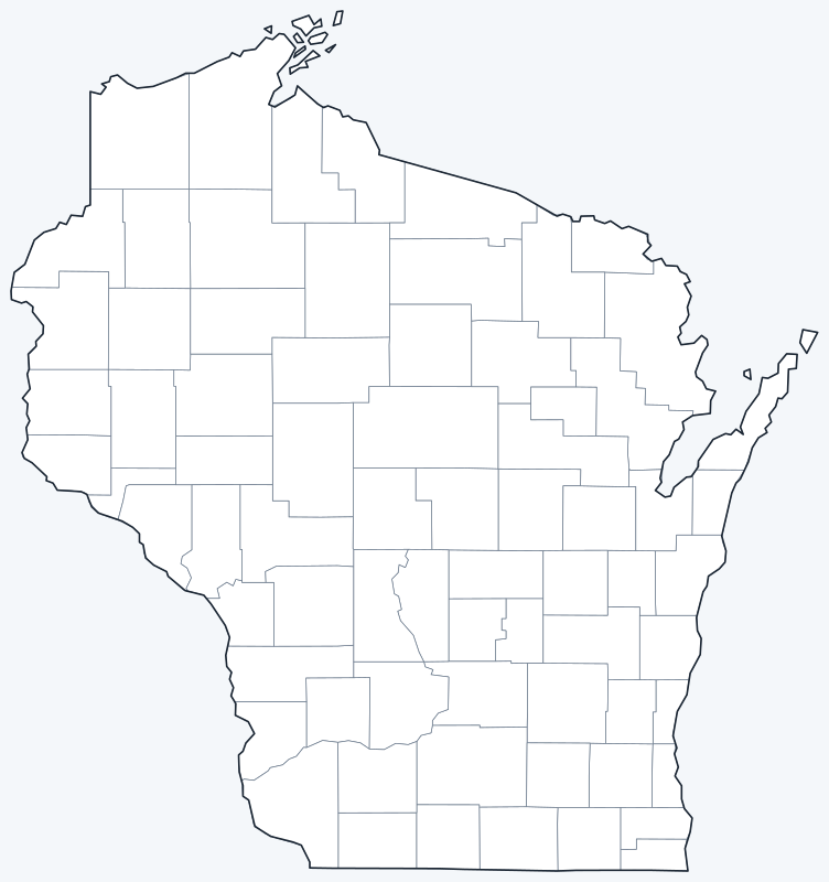
County lines are switched on when the interactive map loads. Hover over a county to see its name, or untick Show counties to hide the lines.
List of Wisconsin counties
| County | County seat | Population (2020) | Land area (sq mi) |
|---|---|---|---|
| Adams | Friendship | 20,654 | 645.6 |
| Ashland | Ashland | 16,027 | 1,045.0 |
| Barron | Barron | 46,711 | 863.0 |
| Bayfield | Washburn | 16,220 | 1,477.9 |
| Brown | Green Bay | 268,740 | 530.1 |
| Buffalo | Alma | 13,317 | 675.8 |
| Burnett | Siren | 16,526 | 821.6 |
| Calumet | Chilton | 52,442 | 318.2 |
| Chippewa | Chippewa Falls | 66,297 | 1,008.4 |
| Clark | Neillsville | 34,659 | 1,209.7 |
| Columbia | Portage | 58,490 | 765.5 |
| Crawford | Prairie du Chien | 16,113 | 570.6 |
| Dane | Madison | 561,504 | 1,196.5 |
| Dodge | Juneau | 89,396 | 875.7 |
| Door | Sturgeon Bay | 30,066 | 482.0 |
| Douglas | Superior | 44,295 | 1,304.3 |
| Dunn | Menomonie | 45,440 | 850.2 |
| Eau Claire | Eau Claire | 105,710 | 637.9 |
| Florence | Florence | 4,558 | 488.1 |
| Fond du Lac | Fond du Lac | 104,154 | 719.6 |
| Forest | Crandon | 9,179 | 1,014.2 |
| Grant | Lancaster | 51,938 | 1,146.9 |
| Green | Monroe | 37,093 | 584.0 |
| Green Lake | Green Lake | 19,018 | 349.5 |
| Iowa | Dodgeville | 23,709 | 762.7 |
| Iron | Hurley | 6,137 | 758.2 |
| Jackson | Black River Falls | 21,145 | 987.9 |
| Jefferson | Jefferson | 84,900 | 556.5 |
| Juneau | Mauston | 26,718 | 767.1 |
| Kenosha | Kenosha | 169,151 | 271.8 |
| Kewaunee | Kewaunee | 20,563 | 342.5 |
| La Crosse | La Crosse | 120,784 | 451.8 |
| Lafayette | Darlington | 16,611 | 633.6 |
| Langlade | Antigo | 19,491 | 870.7 |
| Lincoln | Merrill | 28,415 | 878.7 |
| Manitowoc | Manitowoc | 81,359 | 589.3 |
| Marathon | Wausau | 138,013 | 1,545.2 |
| Marinette | Marinette | 41,872 | 1,399.5 |
| Marquette | Montello | 15,592 | 455.7 |
| Menominee | Keshena | 4,255 | 357.6 |
| Milwaukee | Milwaukee | 939,489 | 241.5 |
| Monroe | Sparta | 46,274 | 900.9 |
| Oconto | Oconto | 38,965 | 997.5 |
| Oneida | Rhinelander | 37,845 | 1,113.9 |
| Outagamie | Appleton | 190,705 | 637.6 |
| Ozaukee | Port Washington | 91,503 | 233.0 |
| Pepin | Durand | 7,318 | 232.0 |
| Pierce | Ellsworth | 42,212 | 574.0 |
| Polk | Balsam Lake | 44,977 | 914.3 |
| Portage | Stevens Point | 70,377 | 800.9 |
| Price | Phillips | 14,054 | 1,254.1 |
| Racine | Racine | 197,727 | 332.6 |
| Richland | Richland Center | 17,304 | 586.1 |
| Rock | Janesville | 163,687 | 718.2 |
| Rusk | Ladysmith | 14,188 | 913.6 |
| Sauk | Baraboo | 65,763 | 831.5 |
| Sawyer | Hayward | 18,074 | 1,257.6 |
| Shawano | Shawano | 40,881 | 893.2 |
| Sheboygan | Sheboygan | 118,034 | 511.5 |
| St. Croix | Hudson | 93,536 | 722.2 |
| Taylor | Medford | 19,913 | 975.1 |
| Trempealeau | Whitehall | 30,760 | 733.0 |
| Vernon | Viroqua | 30,714 | 791.6 |
| Vilas | Eagle River | 23,047 | 857.7 |
| Walworth | Elkhorn | 106,478 | 555.4 |
| Washburn | Shell Lake | 16,623 | 797.1 |
| Washington | West Bend | 136,761 | 430.6 |
| Waukesha | Waukesha | 406,978 | 549.7 |
| Waupaca | Waupaca | 51,812 | 747.7 |
| Waushara | Wautoma | 24,520 | 626.2 |
| Winnebago | Oshkosh | 171,730 | 434.7 |
| Wood | Wisconsin Rapids | 74,207 | 793.0 |
Most populous counties
The five most populous counties had 2,374,438 residents in 2020, 40.3% of Wisconsin’s 5,893,718 people.
- Milwaukee County: 939,489 (15.9% of the state), seat Milwaukee
- Dane County: 561,504 (9.5% of the state), seat Madison
- Waukesha County: 406,978 (6.9% of the state), seat Waukesha
- Brown County: 268,740 (4.6% of the state), seat Green Bay
- Racine County: 197,727 (3.4% of the state), seat Racine
The least populous is Menominee County, with 4,255 residents. Of the 72 counties, 5 had fewer than 10,000 people in 2020.
Largest and smallest counties
By land area, the largest counties are Marathon (1,545.2 sq mi), Bayfield (1,477.9 sq mi) and Marinette (1,399.5 sq mi). The smallest is Pepin County at 232.0 sq mi, followed by Ozaukee (233.0 sq mi) and Milwaukee (241.5 sq mi).
The average Wisconsin county covers 752.3 sq mi of land. The most densely populated is Milwaukee County, with about 3,890 people per sq mi; the least dense is Iron County, with about 8.1.
How counties work in Wisconsin
Each Wisconsin county is governed by an elected county board of supervisors and has a county seat, listed in the table above. Below the county level, the state is divided into cities, villages and towns.
Menominee County, the least populous (4,255 residents), was created in 1961 and corresponds to the Menominee Indian Reservation. At the other end, Milwaukee County, the most populous, is the third-smallest by land area (241.5 sq mi).
The six southeastern counties around Milwaukee (Milwaukee, Waukesha, Racine, Kenosha, Ozaukee and Washington) had 1,941,609 residents in 2020, 32.9% of the state.
Printable Wisconsin county maps
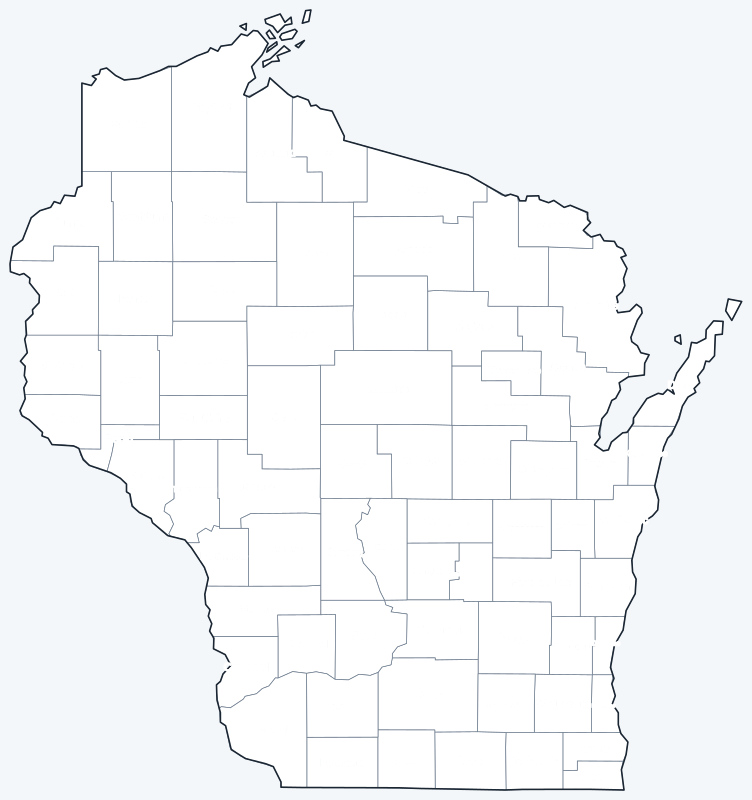
The labeled map shows every county name; the blank version has county lines only, for coloring, quizzes or school projects. Free for personal and classroom use.
Frequently asked questions
How many counties are in Wisconsin?
Wisconsin has 72 counties, each with its own county seat (see the table above).
What is the largest county in Wisconsin?
Marathon County, with 1,545.2 sq mi of land. Its seat is Wausau.
What is the most populous county in Wisconsin?
Milwaukee County, with 939,489 residents in the 2020 Census. Its seat is Milwaukee.
What county is Madison, Wisconsin, in?
Madison, the state capital, is in Dane County and is its county seat. Milwaukee is the seat of Milwaukee County.
Neighboring state county maps
Michigan · Illinois · Iowa · Minnesota
Back to the Wisconsin state map or browse all 50 state maps.
Sources: U.S. Census Bureau (2020 Census, 2020 Gazetteer, boundaries); county seats from Wikipedia county lists cross-checked with Wikidata. Last reviewed October 2026.