Missouri County Map
Missouri has 114 counties plus the independent city of St. Louis, which belongs to no county. St. Louis County is the most populous county with 1,004,125 residents in 2020, and Texas County is the largest by land area at 1,177.3 sq mi. Jefferson City, the capital, is the seat of Cole County.
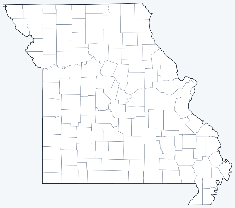
County lines are switched on when the interactive map loads. Hover over a county to see its name, or untick Show counties to hide them.
List of Missouri counties
| County | County seat | Population (2020) | Land area (sq mi) |
|---|---|---|---|
| Adair County | Kirksville | 25,314 | 567.3 |
| Andrew County | Savannah | 18,135 | 432.6 |
| Atchison County | Rock Port | 5,305 | 547.3 |
| Audrain County | Mexico | 24,962 | 692.2 |
| Barry County | Cassville | 34,534 | 778.1 |
| Barton County | Lamar | 11,637 | 592.0 |
| Bates County | Butler | 16,042 | 836.7 |
| Benton County | Warsaw | 19,394 | 704.0 |
| Bollinger County | Marble Hill | 10,567 | 617.9 |
| Boone County | Columbia | 183,610 | 685.6 |
| Buchanan County | St. Joseph | 84,793 | 408.2 |
| Butler County | Poplar Bluff | 42,130 | 694.8 |
| Caldwell County | Kingston | 8,815 | 426.4 |
| Callaway County | Fulton | 44,283 | 834.6 |
| Camden County | Camdenton | 42,745 | 656.0 |
| Cape Girardeau County | Jackson | 81,710 | 578.5 |
| Carroll County | Carrollton | 8,495 | 694.6 |
| Carter County | Van Buren | 5,202 | 507.4 |
| Cass County | Harrisonville | 107,824 | 696.6 |
| Cedar County | Stockton | 14,188 | 474.5 |
| Chariton County | Keytesville | 7,408 | 751.2 |
| Christian County | Ozark | 88,842 | 562.6 |
| Clark County | Kahoka | 6,634 | 504.6 |
| Clay County | Liberty | 253,335 | 397.7 |
| Clinton County | Plattsburg | 21,184 | 418.9 |
| Cole County | Jefferson City | 77,279 | 391.5 |
| Cooper County | Boonville | 17,103 | 564.7 |
| Crawford County | Steelville | 23,056 | 742.5 |
| Dade County | Greenfield | 7,569 | 490.0 |
| Dallas County | Buffalo | 17,071 | 541.0 |
| Daviess County | Gallatin | 8,430 | 563.3 |
| DeKalb County | Maysville | 11,029 | 421.4 |
| Dent County | Salem | 14,421 | 752.8 |
| Douglas County | Ava | 11,578 | 813.6 |
| Dunklin County | Kennett | 28,283 | 541.9 |
| Franklin County | Union | 104,682 | 922.6 |
| Gasconade County | Hermann | 14,794 | 519.0 |
| Gentry County | Albany | 6,162 | 491.4 |
| Greene County | Springfield | 298,915 | 675.3 |
| Grundy County | Trenton | 9,808 | 435.3 |
| Harrison County | Bethany | 8,157 | 722.5 |
| Henry County | Clinton | 21,946 | 696.9 |
| Hickory County | Hermitage | 8,279 | 398.8 |
| Holt County | Oregon | 4,223 | 462.7 |
| Howard County | Fayette | 10,151 | 463.8 |
| Howell County | West Plains | 39,750 | 927.2 |
| Iron County | Ironton | 9,537 | 550.3 |
| Jackson County | Independence and Kansas City | 717,204 | 604.5 |
| Jasper County | Carthage | 122,761 | 638.5 |
| Jefferson County | Hillsboro | 226,739 | 656.4 |
| Johnson County | Warrensburg | 54,013 | 829.3 |
| Knox County | Edina | 3,744 | 504.0 |
| Laclede County | Lebanon | 36,039 | 764.6 |
| Lafayette County | Lexington | 32,984 | 628.3 |
| Lawrence County | Mount Vernon | 38,001 | 611.7 |
| Lewis County | Monticello | 10,032 | 505.0 |
| Lincoln County | Troy | 59,574 | 626.6 |
| Linn County | Linneus | 11,874 | 615.6 |
| Livingston County | Chillicothe | 14,557 | 532.3 |
| Macon County | Macon | 15,209 | 801.2 |
| Madison County | Fredericktown | 12,626 | 494.4 |
| Maries County | Vienna | 8,432 | 527.0 |
| Marion County | Palmyra | 28,525 | 436.9 |
| McDonald County | Pineville | 23,303 | 539.4 |
| Mercer County | Princeton | 3,538 | 453.8 |
| Miller County | Tuscumbia | 24,722 | 592.6 |
| Mississippi County | Charleston | 12,577 | 411.6 |
| Moniteau County | California | 15,473 | 415.0 |
| Monroe County | Paris | 8,666 | 647.6 |
| Montgomery County | Montgomery City | 11,322 | 535.0 |
| Morgan County | Versailles | 21,006 | 597.6 |
| New Madrid County | New Madrid | 16,434 | 674.9 |
| Newton County | Neosho | 58,648 | 624.8 |
| Nodaway County | Maryville | 21,241 | 877.0 |
| Oregon County | Alton | 8,635 | 789.8 |
| Osage County | Linn | 13,274 | 606.6 |
| Ozark County | Gainesville | 8,553 | 745.0 |
| Pemiscot County | Caruthersville | 15,661 | 492.6 |
| Perry County | Perryville | 18,956 | 474.4 |
| Pettis County | Sedalia | 42,980 | 682.2 |
| Phelps County | Rolla | 44,638 | 671.8 |
| Pike County | Bowling Green | 17,587 | 670.4 |
| Platte County | Platte City | 106,718 | 419.8 |
| Polk County | Bolivar | 31,519 | 635.5 |
| Pulaski County | Waynesville | 53,955 | 547.1 |
| Putnam County | Unionville | 4,681 | 517.3 |
| Ralls County | New London | 10,355 | 469.8 |
| Randolph County | Huntsville | 24,716 | 482.7 |
| Ray County | Richmond | 23,158 | 569.0 |
| Reynolds County | Centerville | 6,096 | 808.5 |
| Ripley County | Doniphan | 10,679 | 629.5 |
| Saline County | Marshall | 23,333 | 755.5 |
| Schuyler County | Lancaster | 4,032 | 307.3 |
| Scotland County | Memphis | 4,716 | 436.5 |
| Scott County | Benton | 38,059 | 420.0 |
| Shannon County | Eminence | 7,031 | 1,003.8 |
| Shelby County | Shelbyville | 6,103 | 500.9 |
| St. Charles County | St. Charles | 405,262 | 560.5 |
| St. Clair County | Osceola | 9,284 | 675.0 |
| St. Francois County | Farmington | 66,922 | 451.9 |
| St. Louis County | Clayton | 1,004,125 | 507.9 |
| St. Louis (independent city) | — | 301,578 | 61.7 |
| Ste. Genevieve County | Ste. Genevieve | 18,479 | 499.2 |
| Stoddard County | Bloomfield | 28,672 | 823.1 |
| Stone County | Galena | 31,076 | 463.8 |
| Sullivan County | Milan | 5,999 | 648.0 |
| Taney County | Forsyth | 56,066 | 632.3 |
| Texas County | Houston | 24,487 | 1,177.3 |
| Vernon County | Nevada | 19,707 | 826.4 |
| Warren County | Warrenton | 35,532 | 428.6 |
| Washington County | Potosi | 23,514 | 759.9 |
| Wayne County | Greenville | 10,974 | 759.2 |
| Webster County | Marshfield | 39,085 | 592.6 |
| Worth County | Grant City | 1,973 | 266.6 |
| Wright County | Hartville | 18,188 | 681.8 |
St. Louis is an independent city, not part of any county, so it has no county seat (—). It is listed with the counties because the Census Bureau treats it as a county-equivalent.
Most populous counties
The five most populous counties are home to 43.5% of Missouri’s 6,154,913 residents (2020 Census).
- St. Louis County (Clayton): 1,004,125, 16.3% of the state
- Jackson County (Independence and Kansas City): 717,204, 11.7% of the state
- St. Charles County (St. Charles): 405,262, 6.6% of the state
- Greene County (Springfield): 298,915, 4.9% of the state
- Clay County (Liberty): 253,335, 4.1% of the state
The independent city of St. Louis, counted separately from St. Louis County, had 301,578 residents. Worth County, on the Iowa border, is the least populous county, with 1,973 residents.
Largest and smallest counties
Texas County, in the Ozarks of south-central Missouri, is the largest county at 1,177.3 sq mi of land, followed by Shannon County (1,003.8 sq mi) and Howell County (927.2 sq mi). Worth County is the smallest county at 266.6 sq mi. The independent city of St. Louis covers 61.7 sq mi of land.
St. Louis city and other county facts
The City of St. Louis separated from St. Louis County in 1876 and has been an independent city ever since. It is a county-equivalent with no county seat, which is why it appears in the table with a dash. St. Louis County, which borders the city on the north, west and south, is a separate government with its seat in Clayton.
Jackson County has two county seats, Independence and Kansas City. Kansas City itself extends into Jackson, Clay, Platte and Cass counties.
Printable Missouri county maps
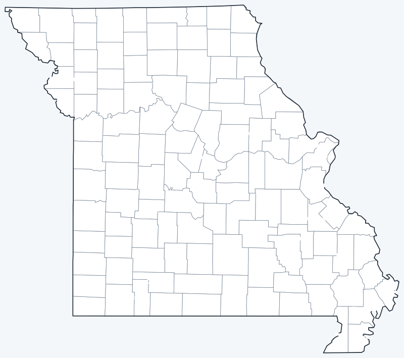
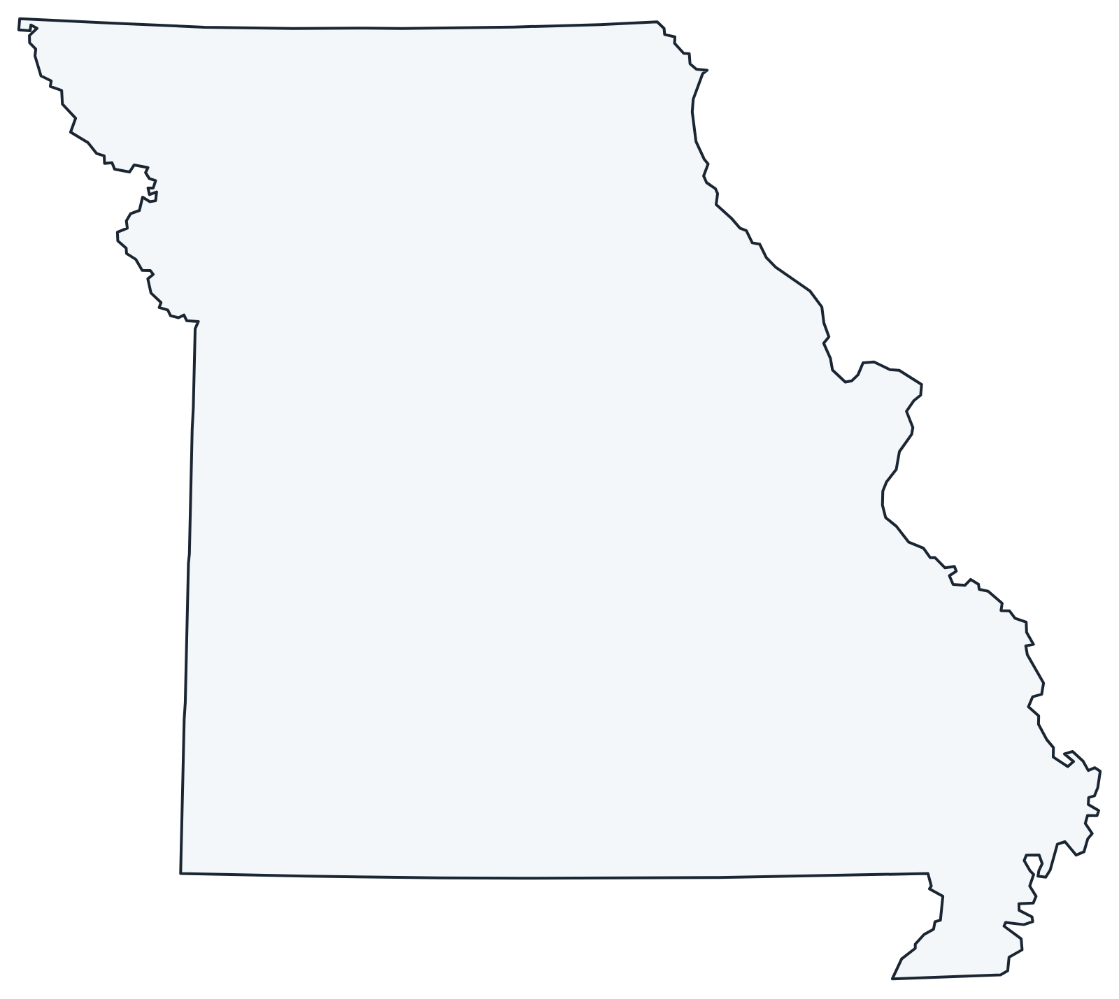
Print the labeled map as a reference or the blank map for county quizzes and coloring; both are SVG files that print sharply at any size.
Frequently asked questions
How many counties are in Missouri?
Missouri has 114 counties. The independent city of St. Louis is a separate county-equivalent, for 115 in all.
What is the largest county in Missouri?
Texas County, with 1,177.3 sq mi of land. Its seat is Houston.
What is the most populous county in Missouri?
St. Louis County, with 1,004,125 residents in 2020. Its seat is Clayton.
What county is St. Louis in?
None. The City of St. Louis is an independent city outside any county. St. Louis County is a separate jurisdiction next to it.
More Missouri and nearby maps
Back to the Missouri state map for cities, highways and geography.
Neighboring county maps: Arkansas county map · Illinois county map · Iowa county map · Kansas county map · Kentucky county map · Nebraska county map · Oklahoma county map · Tennessee county map
Browse all 50 state maps.
Sources: U.S. Census Bureau (2020 Census, 2020 Gazetteer, boundaries); county seats from Wikipedia county lists cross-checked with Wikidata. Last reviewed October 2026.