Pennsylvania County Map
Pennsylvania has 67 counties. Philadelphia County, which shares its borders with the city of Philadelphia, is the most populous with 1,603,797 people in 2020, and Lycoming County is the largest at 1,228.9 sq mi of land. The capital, Harrisburg, is the seat of Dauphin County.
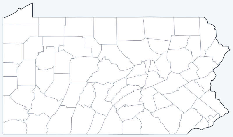
County lines are switched on when the interactive map loads, along with Pennsylvania’s largest cities (capital in red). Hover a county to see its name, or untick Show counties to hide them.
List of Pennsylvania counties
| County | County seat | Population (2020) | Land area (sq mi) |
|---|---|---|---|
| Adams County | Gettysburg | 103,852 | 518.7 |
| Allegheny County | Pittsburgh | 1,250,578 | 730.0 |
| Armstrong County | Kittanning | 65,558 | 653.3 |
| Beaver County | Beaver | 168,215 | 434.7 |
| Bedford County | Bedford | 47,577 | 1,012.2 |
| Berks County | Reading | 428,849 | 856.4 |
| Blair County | Hollidaysburg | 122,822 | 525.3 |
| Bradford County | Towanda | 59,967 | 1,147.5 |
| Bucks County | Doylestown | 646,538 | 604.4 |
| Butler County | Butler | 193,763 | 789.5 |
| Cambria County | Ebensburg | 133,472 | 687.5 |
| Cameron County | Emporium | 4,547 | 396.2 |
| Carbon County | Jim Thorpe | 64,749 | 381.3 |
| Centre County | Bellefonte | 158,172 | 1,108.7 |
| Chester County | West Chester | 534,413 | 750.5 |
| Clarion County | Clarion | 37,241 | 600.8 |
| Clearfield County | Clearfield | 80,562 | 1,145.3 |
| Clinton County | Lock Haven | 37,450 | 888.0 |
| Columbia County | Bloomsburg | 64,727 | 483.2 |
| Crawford County | Meadville | 83,938 | 1,012.4 |
| Cumberland County | Carlisle | 259,469 | 545.5 |
| Dauphin County | Harrisburg | 286,401 | 524.9 |
| Delaware County | Media | 576,830 | 183.8 |
| Elk County | Ridgway | 30,990 | 826.9 |
| Erie County | Erie | 270,876 | 798.9 |
| Fayette County | Uniontown | 128,804 | 790.8 |
| Forest County | Tionesta | 6,973 | 427.3 |
| Franklin County | Chambersburg | 155,932 | 772.3 |
| Fulton County | McConnellsburg | 14,556 | 437.6 |
| Greene County | Waynesburg | 35,954 | 575.9 |
| Huntingdon County | Huntingdon | 44,092 | 874.7 |
| Indiana County | Indiana | 83,246 | 827.4 |
| Jefferson County | Brookville | 44,492 | 652.4 |
| Juniata County | Mifflintown | 23,509 | 391.4 |
| Lackawanna County | Scranton | 215,896 | 459.0 |
| Lancaster County | Lancaster | 552,984 | 943.9 |
| Lawrence County | New Castle | 86,070 | 357.4 |
| Lebanon County | Lebanon | 143,257 | 361.8 |
| Lehigh County | Allentown | 374,557 | 345.3 |
| Luzerne County | Wilkes-Barre | 325,594 | 889.7 |
| Lycoming County | Williamsport | 114,188 | 1,228.9 |
| McKean County | Smethport | 40,432 | 979.7 |
| Mercer County | Mercer | 110,652 | 672.5 |
| Mifflin County | Lewistown | 46,143 | 411.0 |
| Monroe County | Stroudsburg | 168,327 | 608.4 |
| Montgomery County | Norristown | 856,553 | 483.0 |
| Montour County | Danville | 18,136 | 130.2 |
| Northampton County | Easton | 312,951 | 369.8 |
| Northumberland County | Sunbury | 91,647 | 457.7 |
| Perry County | New Bloomfield | 45,842 | 551.4 |
| Philadelphia County | Philadelphia | 1,603,797 | 134.4 |
| Pike County | Milford | 58,535 | 544.9 |
| Potter County | Coudersport | 16,396 | 1,081.2 |
| Schuylkill County | Pottsville | 143,049 | 778.6 |
| Snyder County | Middleburg | 39,736 | 328.8 |
| Somerset County | Somerset | 74,129 | 1,075.0 |
| Sullivan County | Laporte | 5,840 | 449.9 |
| Susquehanna County | Montrose | 38,434 | 823.5 |
| Tioga County | Wellsboro | 41,045 | 1,133.8 |
| Union County | Lewisburg | 42,681 | 316.0 |
| Venango County | Franklin | 50,454 | 674.3 |
| Warren County | Warren | 38,587 | 884.3 |
| Washington County | Washington | 209,349 | 857.0 |
| Wayne County | Honesdale | 51,155 | 725.8 |
| Westmoreland County | Greensburg | 354,663 | 1,027.7 |
| Wyoming County | Tunkhannock | 26,069 | 397.4 |
| York County | York | 456,438 | 904.4 |
Most populous counties
Pennsylvania had 13,002,700 residents in 2020. The five most populous counties held 37.9% of them:
- Philadelphia County: 1,603,797 (12.3% of the state)
- Allegheny County: 1,250,578 (9.6% of the state)
- Montgomery County: 856,553 (6.6% of the state)
- Bucks County: 646,538 (5.0% of the state)
- Delaware County: 576,830 (4.4% of the state)
Philadelphia’s four suburban counties, Bucks, Chester, Delaware and Montgomery, had 2,614,334 people together, more than Philadelphia County itself. The least populous county is Cameron County, with 4,547 residents, followed by Sullivan County (5,840) and Forest County (6,973), all rural counties in the northern half of the state.
Largest and smallest counties
Lycoming County, around Williamsport, is the largest county at 1,228.9 sq mi of land. Bradford County (1,147.5 sq mi) and Clearfield County (1,145.3 sq mi) come next. The average Pennsylvania county covers 667.8 sq mi of land.
The smallest county is Montour County, at 130.2 sq mi, followed by Philadelphia County (134.4 sq mi) and Delaware County (183.8 sq mi).
How Pennsylvania counties work
Philadelphia is a consolidated city-county: the city and county were merged in 1854 and share the same boundaries, so there are no other municipalities in Philadelphia County. Everywhere else, counties are divided into separate municipalities such as cities, boroughs and townships.
Most Pennsylvania counties are run by a board of three elected commissioners. A few have adopted home rule charters; Allegheny County, for example, has an elected county executive and county council. Its seat is Pittsburgh.
Printable Pennsylvania county maps
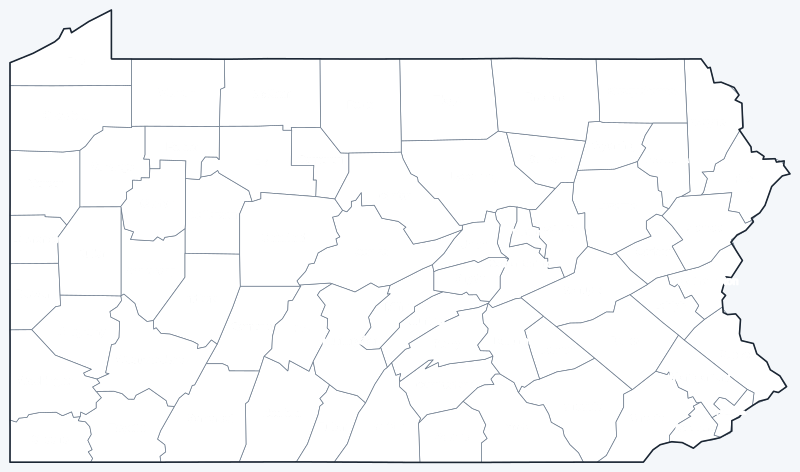
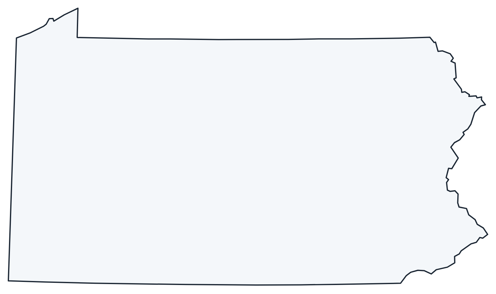
Download the labeled map with every county name, or the blank version for quizzes and coloring; both are SVG files that print sharply at any size.
Frequently asked questions
How many counties are in Pennsylvania?
There are 67 counties. Philadelphia County is the most populous and Lycoming County is the largest by land area.
What is the largest county in Pennsylvania?
Lycoming County, with 1,228.9 sq mi of land. By population, the largest is Philadelphia County.
What is the smallest county in Pennsylvania?
Montour County, with 130.2 sq mi of land. The least populous is Cameron County, with 4,547 residents in 2020.
What county is Pittsburgh in?
Allegheny County, which had 1,250,578 residents in 2020, the second most of any Pennsylvania county. Pittsburgh is its county seat.
More maps
Back to the Pennsylvania state map. Neighboring states: Delaware county map · Maryland county map · New Jersey county map · New York county map · Ohio county map · West Virginia county map.
Browse all 50 state maps.
Sources: U.S. Census Bureau (2020 Census, 2020 Gazetteer, boundaries); county seats: Wikipedia and Wikidata. Last reviewed October 2026.